Day 11: Tulameen, BC -> Gillis Lake, BC
Jeremy decides to ignore the literal warning signs and gets bitten
Date: May 26, 2023
Start: Tulameen, BC (Otter Lake Campground)
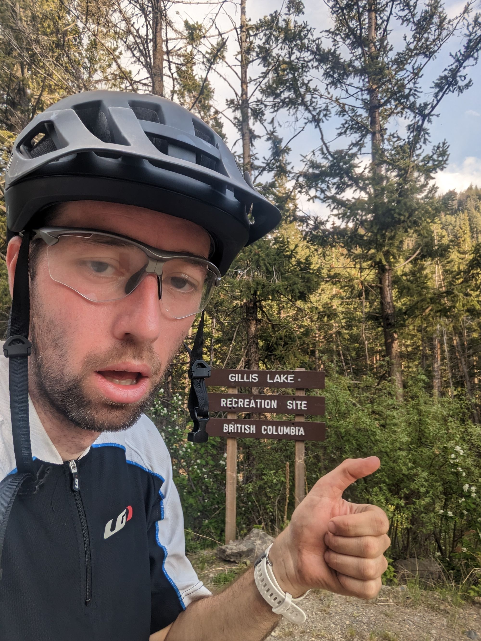
End: Gillis Lake Recreation Site
Distance: 54km
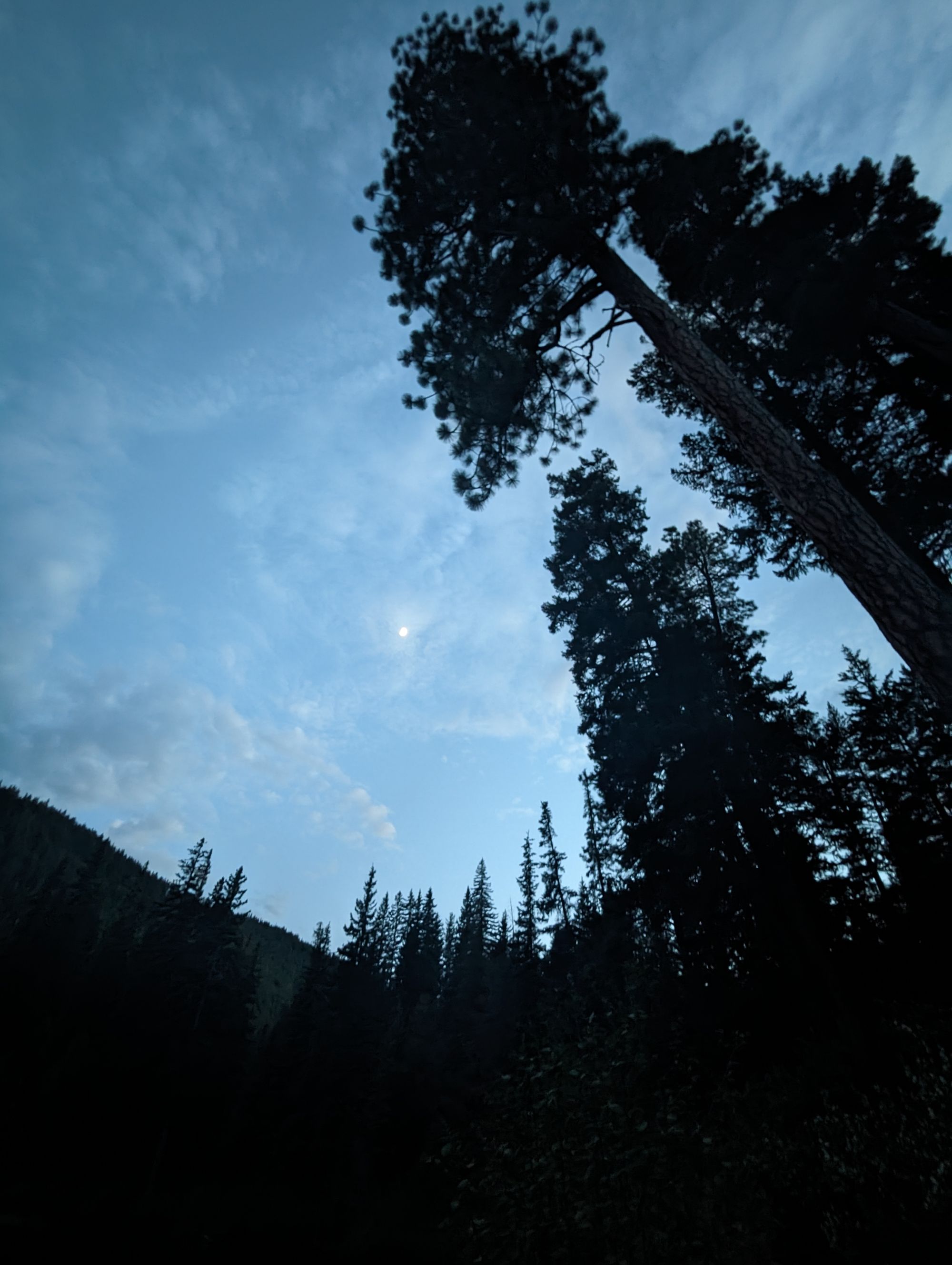
It had been another late night finish, so I slept in again. 7:30am is about when the Sun starts to shine through enough to warm things up, and this morning it was right on cue. I started packing and made breakfast. Two of the groundskeepers for the park stopped by and quizzed me on my plans. They offered advice on what they thought was possible, and warned me that the Kettle Valley Rail Trail was largely destroyed in the flooding of 2021, and has since been mostly abandoned from Princeton onward. They did some internet searches to ensure I could make it to Merritt and around to Highway 1 if need be. They were really friendly and helpful! (Thanks Cam and Don!)
I'd like to say I was slow this morning, but the truth is that I was typing out blog posts all morning. My memories of the ride get fuzzy after two days so I try to keep up. Still no internet or cell signal to make the posts, but the drafts are saved! I spent until about 10am writing and eating breakfast. IF YOU'RE READING THIS RIGHT NOW YOU CAN'T MAKE FUN OF ME FOR BEING SLOW....THESE BLOG POSTS TAKE A LOT OF TIME!
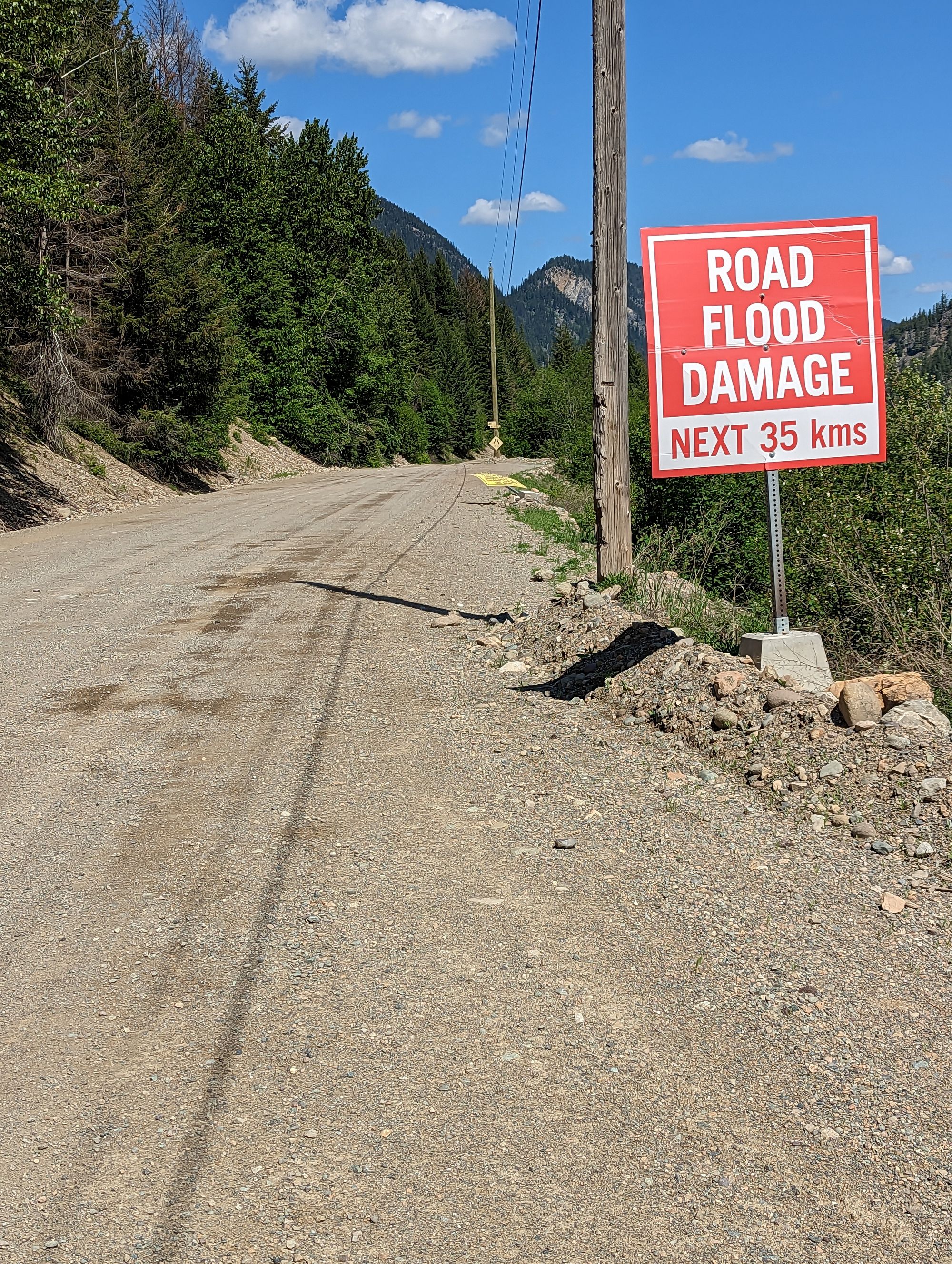
The plan for the day was to head north on the Coalmont Road until Thalia (which is a place on the map, but I'm not sure there's actually anything there) and jump back onto the Kettle Valley Rail Trail (KVRT) and take it 9.5km to Brookmere, BC. The only other option to get to Brookmere was a 30km route by dirt road that looked circuitous. I knew the KVRT was closed in that section, and I'd been warned against washouts, but I suspected it was still passable.
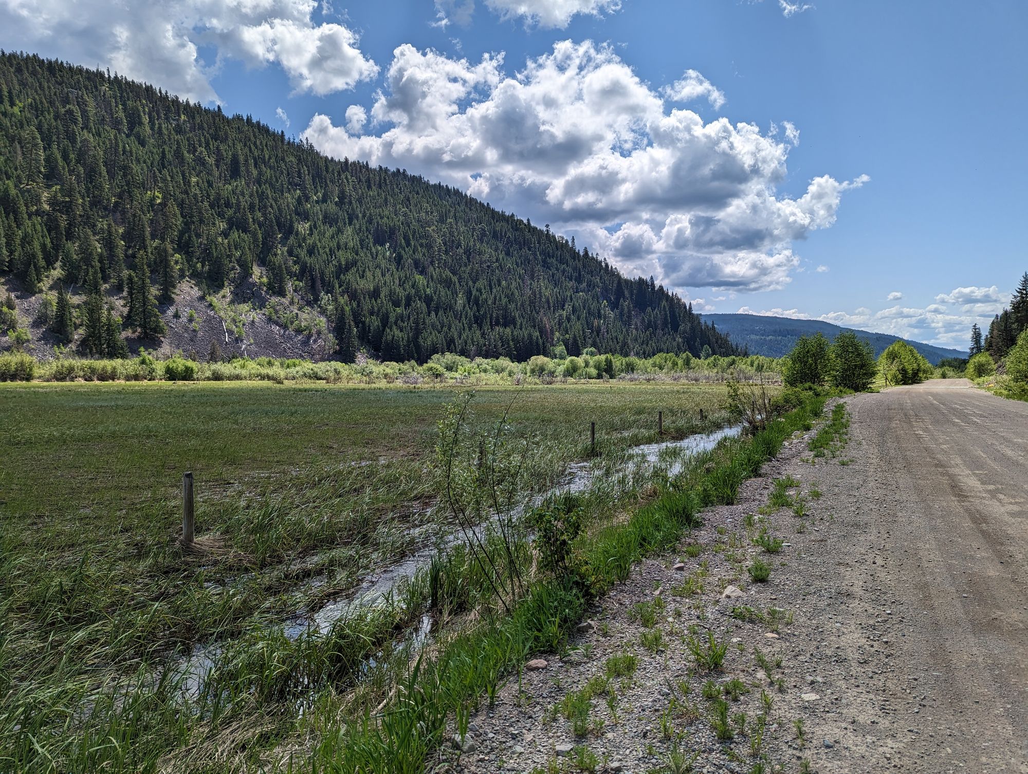
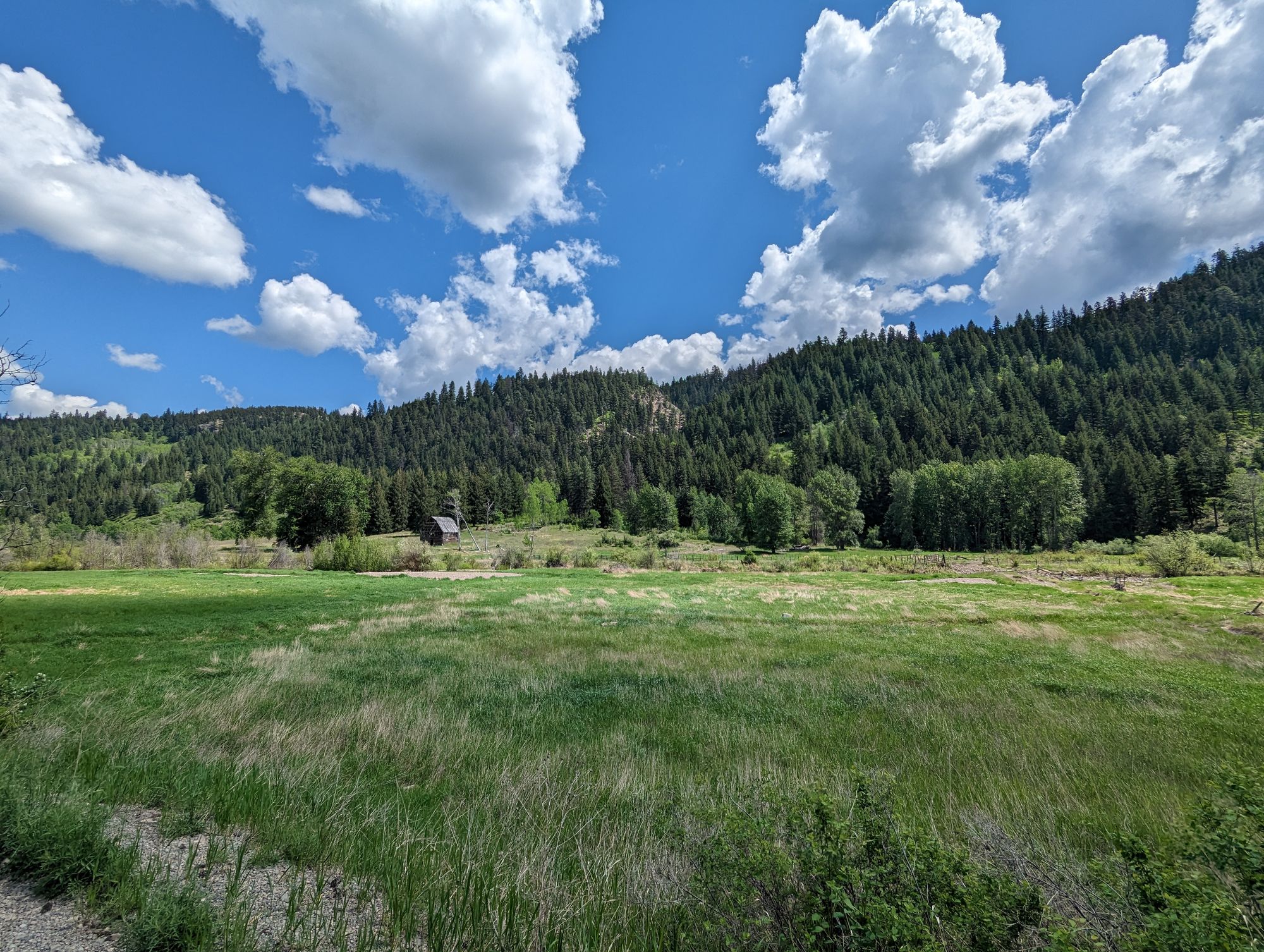
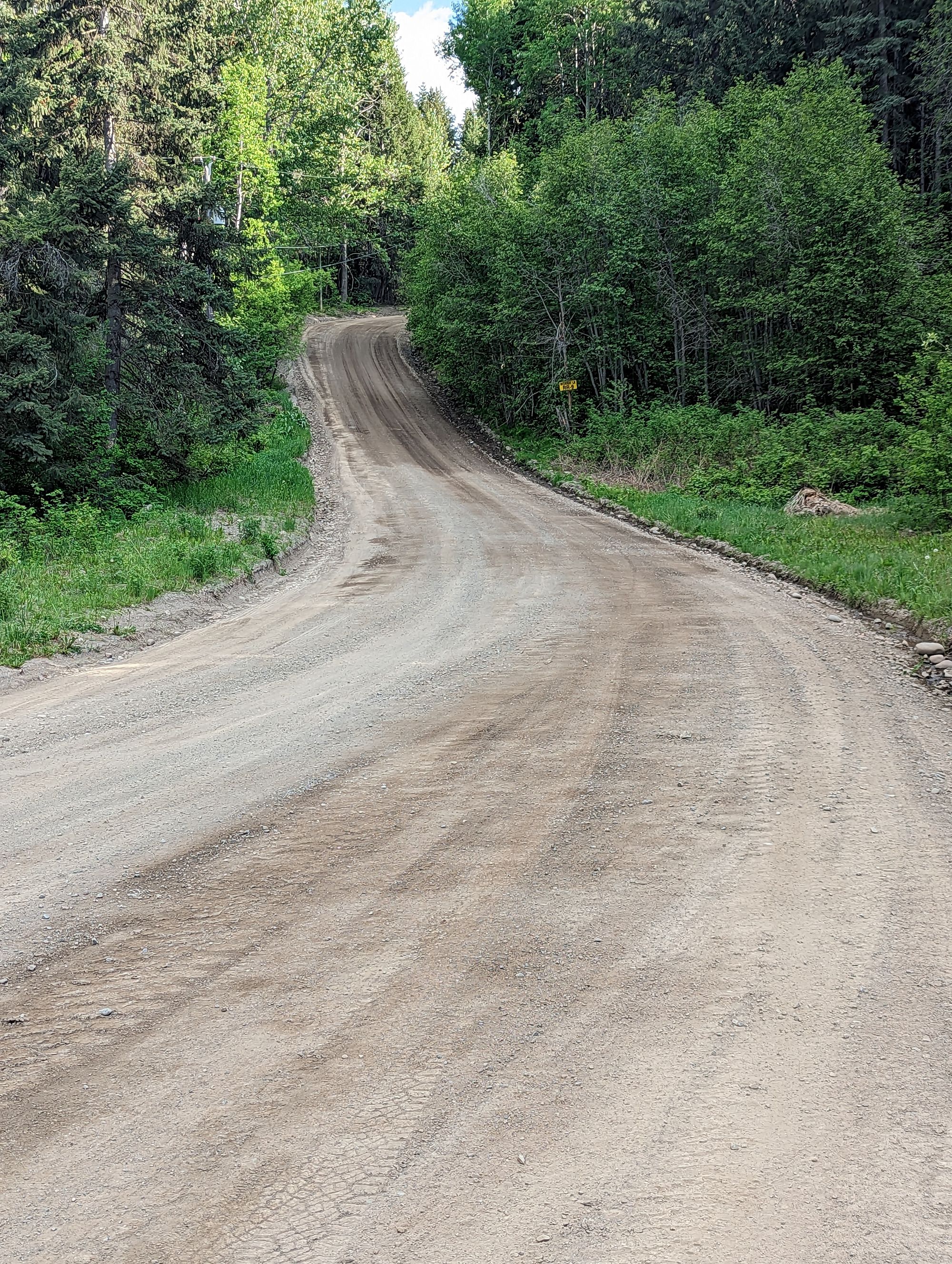
I packed and left at 11am. The Coalmont Road almost immediately turned to gravel as I headed north. This slowed me down, but it was a radiant, sunny day and I was in a valley big enough for one farm at a time, stretching end to end down the valley. They had old barns with broken backs that slumped and were slowly being reclaimed by the earth, hinting at some former life. Some of the fields were flooded and filled with geese and ducks. It was picturesque. The entire valley from Coalmont is probably my favourite place on the ride so far for its beauty. It took about 1.5 hours to get the 20km to Thalia.
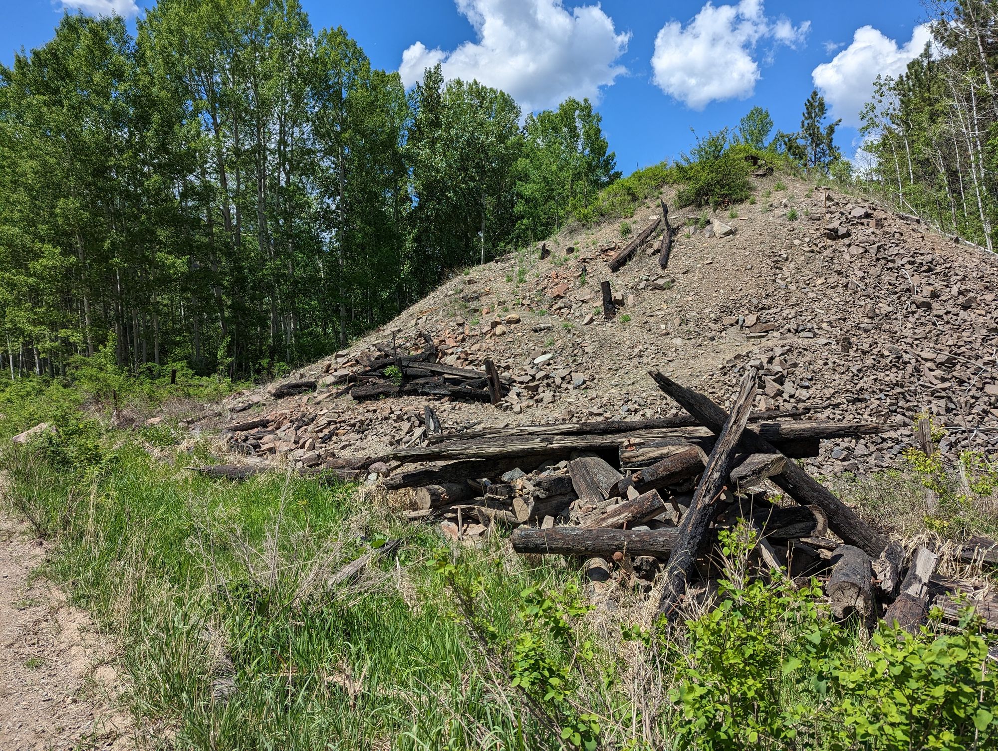
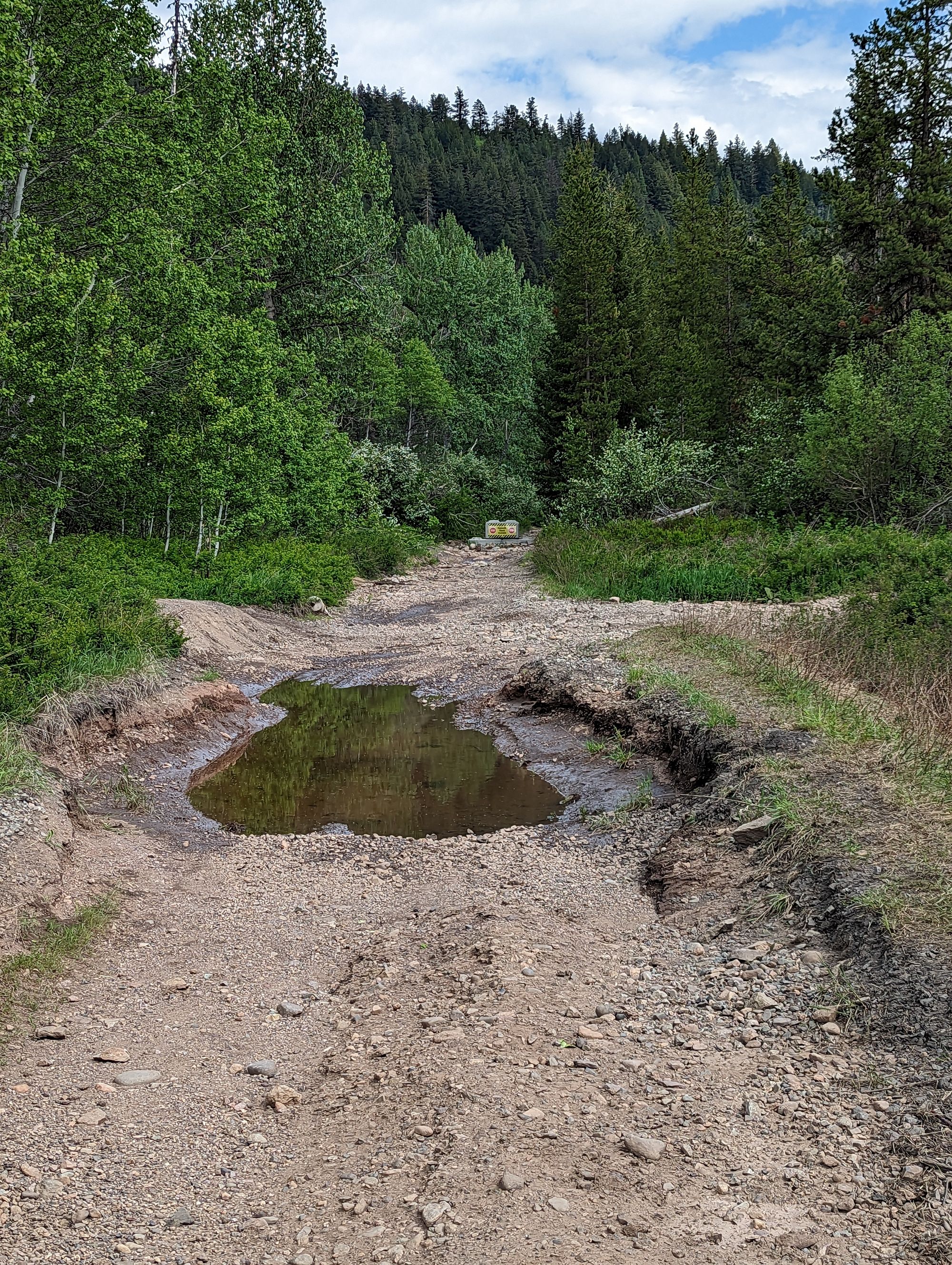
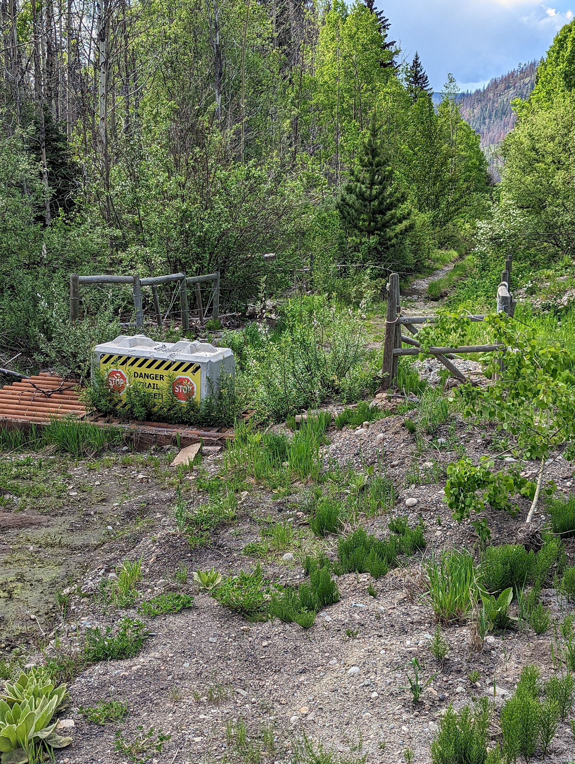
I found the KVRT because a trestle had once crossed over the Coalmont road and there was plenty of evidence that it had burned down at some point in the distant past. It was now about 12:45pm and I decided to eat lunch in the shade of the trees where the trail was marked as closed with blocks of concrete. It was a good choice, because I was about to have a very long day...
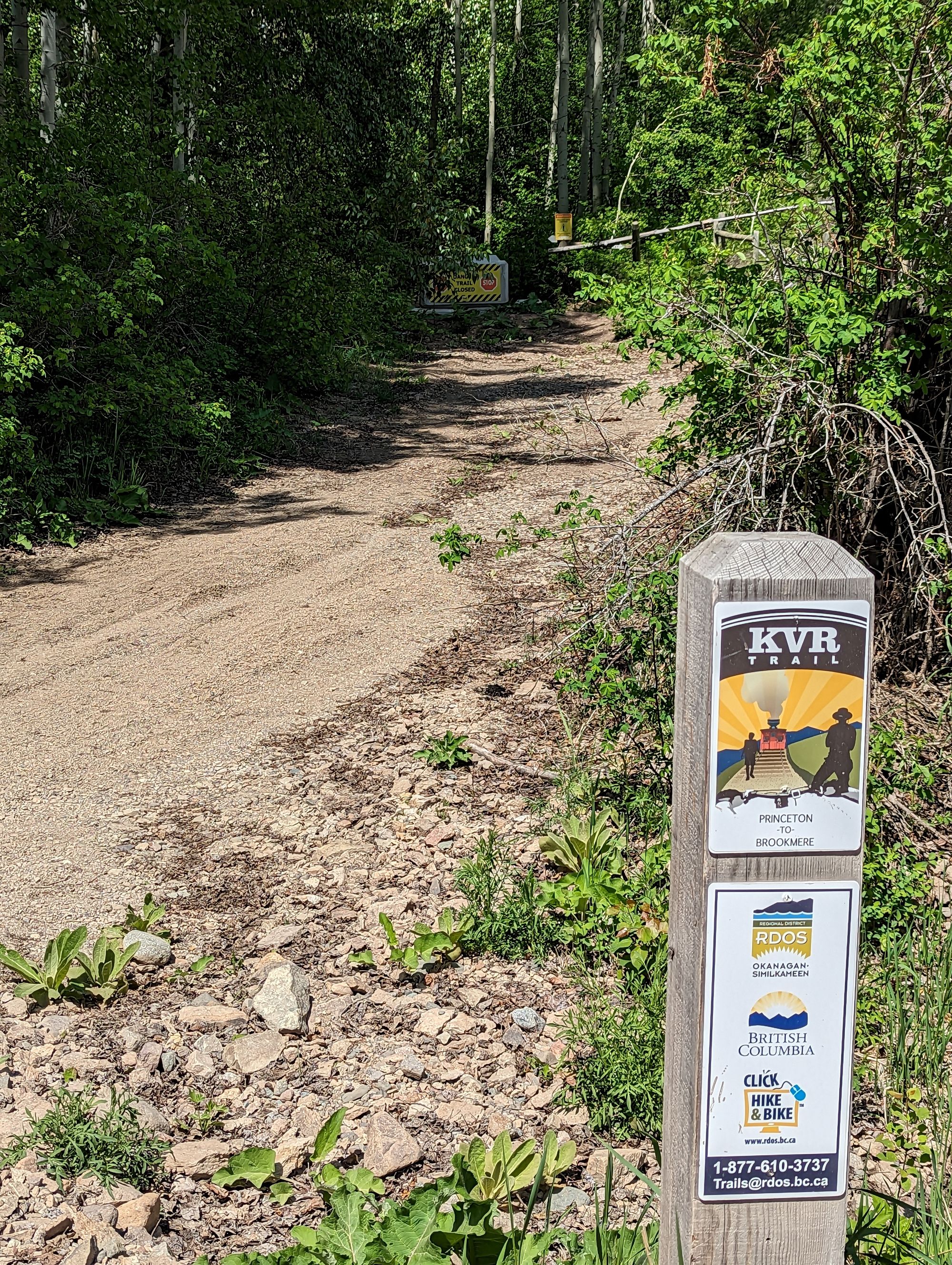
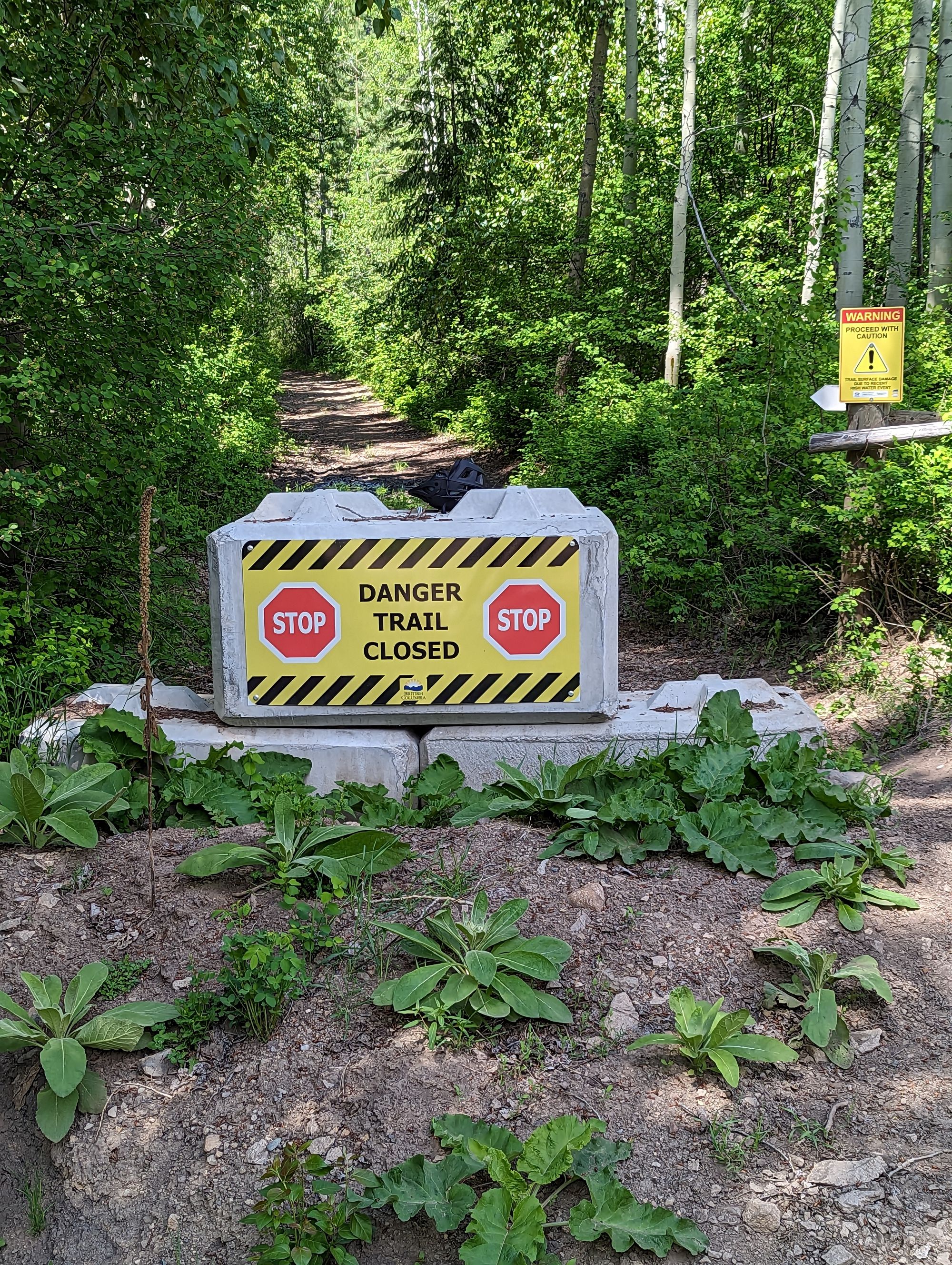
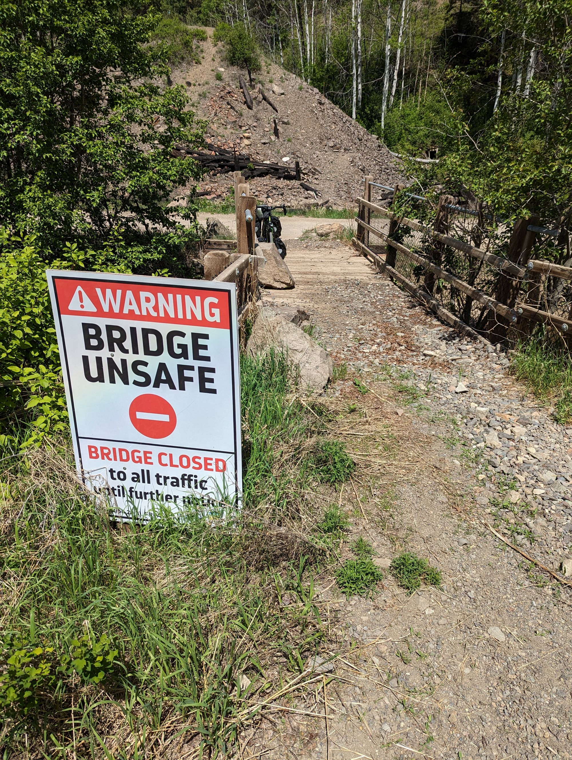
I checked and found the trail was only 9.5km to Brookmere. Very doable. I started off and saw lots of evidence that people had been using the trail. Mostly ATV tracks, but at least one other bicycle had been along it recently and this was a good sign. There was the odd rock fall, but never anything more than grapefruit sized stones on the trail. Then, at about 2.5km I found the reason the trail was closed.
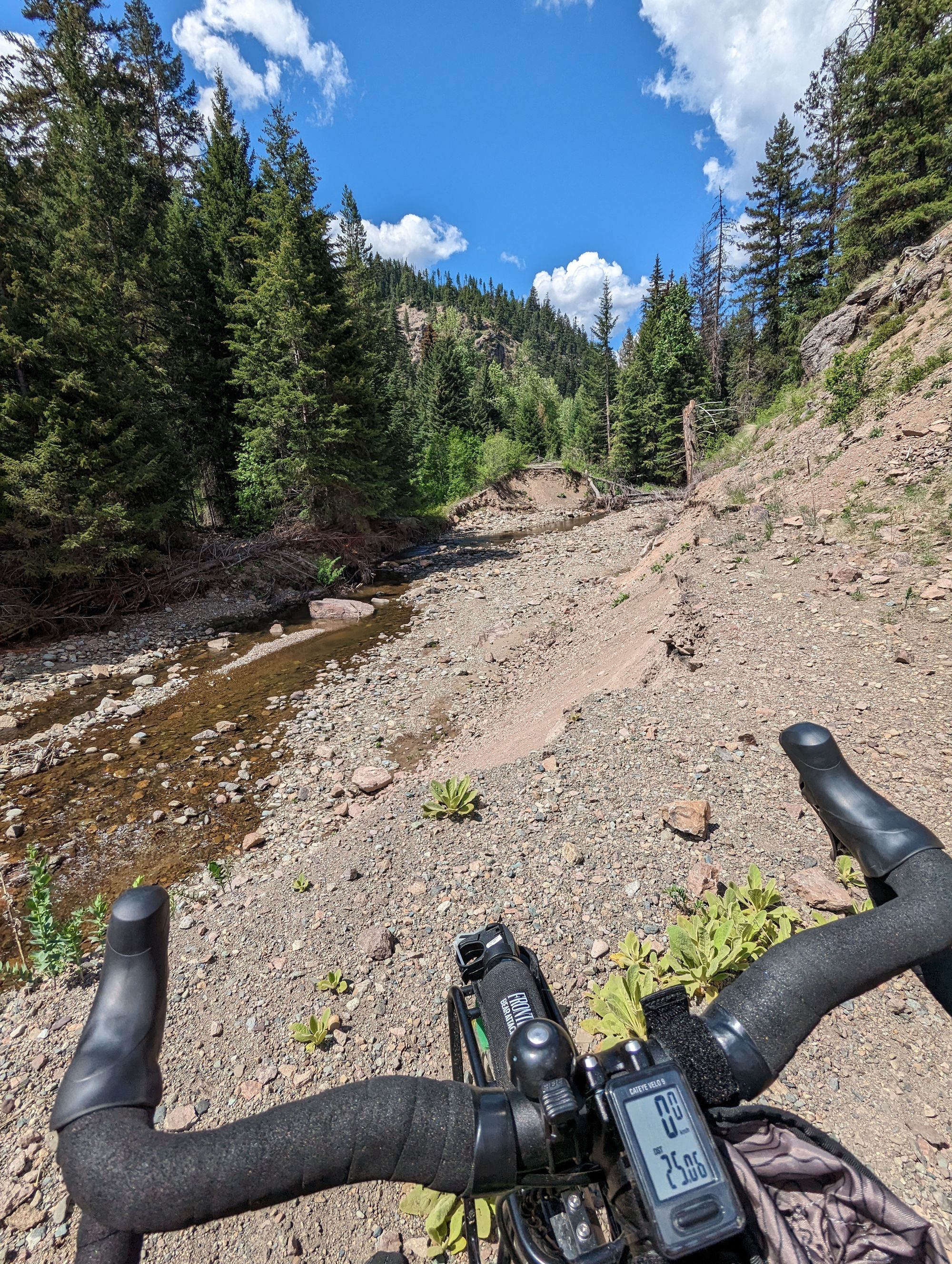
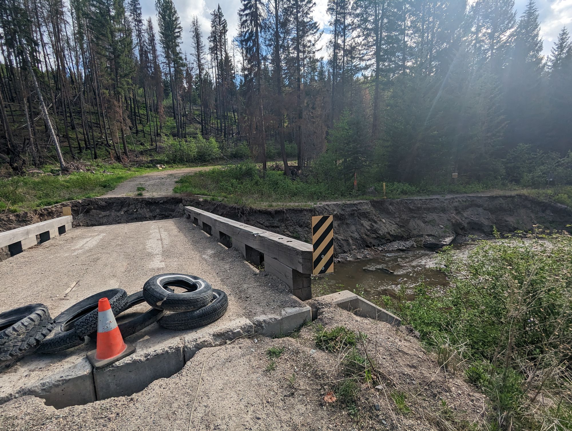
The trail had obviously gone over some kind of stream. And that stream had obviously turned into a torrent at some point, and smashed the trail. There was a chasm about 50 meters across where the trail should have been. Thankfully the stream was quite mellow now, and I could see the trail ahead of me. I decided that I would ford the stream. My years of playing Oregon Trail had not been in vain!

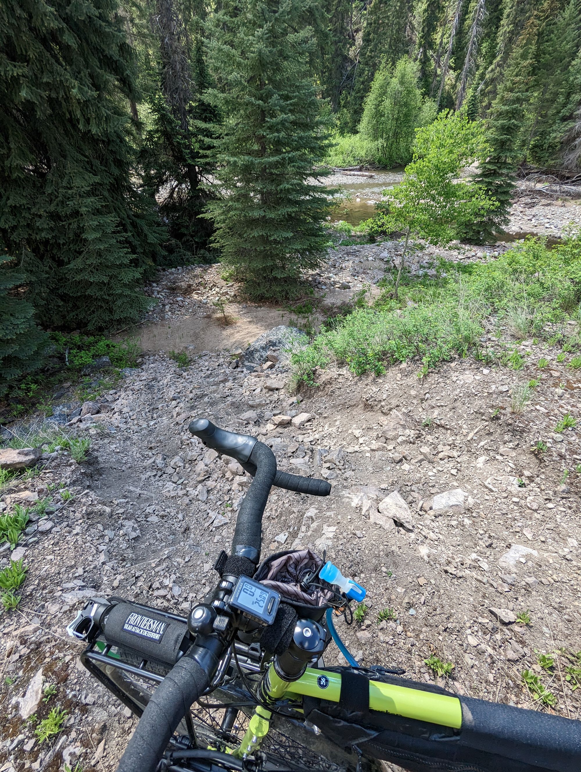
I got my bike down a slope to the stream, took off my shoes, rolled up my pants, and started across. The water was cold, but not so cold that it hurt. The tricky part was getting the fully loaded bike across, because the river stones meant it could only go in spurts and got easily stuck in ruts. I was also careful to not push it too hard, lest I break a spoke or bend the tire or damage the drive train. At some point I got it wedged at an odd angle and - trying to make sure I didn't put pressure on it - lost my footing and dropped my shoes in the creek. They didn't float away, but the bike tried to lay itself down and we both ended up at an odd angle half in the water. I managed to pull it up and got across. I cleaned my feet off, put the wet bike shoes back on, and started for the trail.
...except the trail was much higher up than I was, and there was no sign of how to get up there. I could see ATV tracks, and I tried following them but they went through some heavy brush. I left my bike and set out for a personal reconnoiter through the scrub.
This is when the mosquitoes found me.
It started with a few, then tens, and finally at least 100. They were so thick they would fly into my nose. I flailed and clapped and everywhere I'd hit myself I'd find one. It was maddening. If my sanity dropped to zero there was no way I'd make it through. I realized that standing in the brush was a problem and so pushed through it and found the trail again. I ran back to my bike and started pushing it to the spot I'd found, except it didn't seem like the bike would fit with all the bags. So I took the 4 pannier bags off, and in groups of two ran them up to the trail. When I got the first set up I looked down the trail and found the next obstacle: another washout.
But this one was bigger.
Almost 200 meters across and with huge log jams in places. Thankfully it was all dry and except for one step into the creek I could cross it pretty easily. I went back and forth 5 times. Twice for my front panniers. Twice for my rear panniers. And once for the bike. At one point I had my bike in one hand and a small tree in the other as I leaned out over a ledge to drop the bike down 2 meters, using the tree to keep me from falling. I could hear every one of you saying "Be careful!" and realized this was the kind of moment you'd been imaginging. I had to break my promise this time!
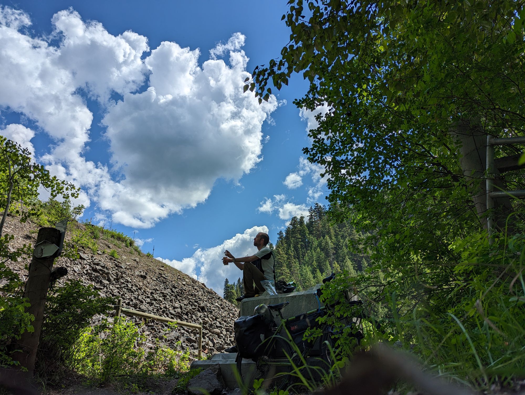
By the time I was across it had been almost 2 hours. I'd donated almost a pint of blood to the mosquitoes. My feet were wet, and I was quite tired. I still had another 7km till Brookmere and no idea how many more of these washouts I'd find. There are no pictures of this section because I was too busy getting across and getting away from the mosquitoes.
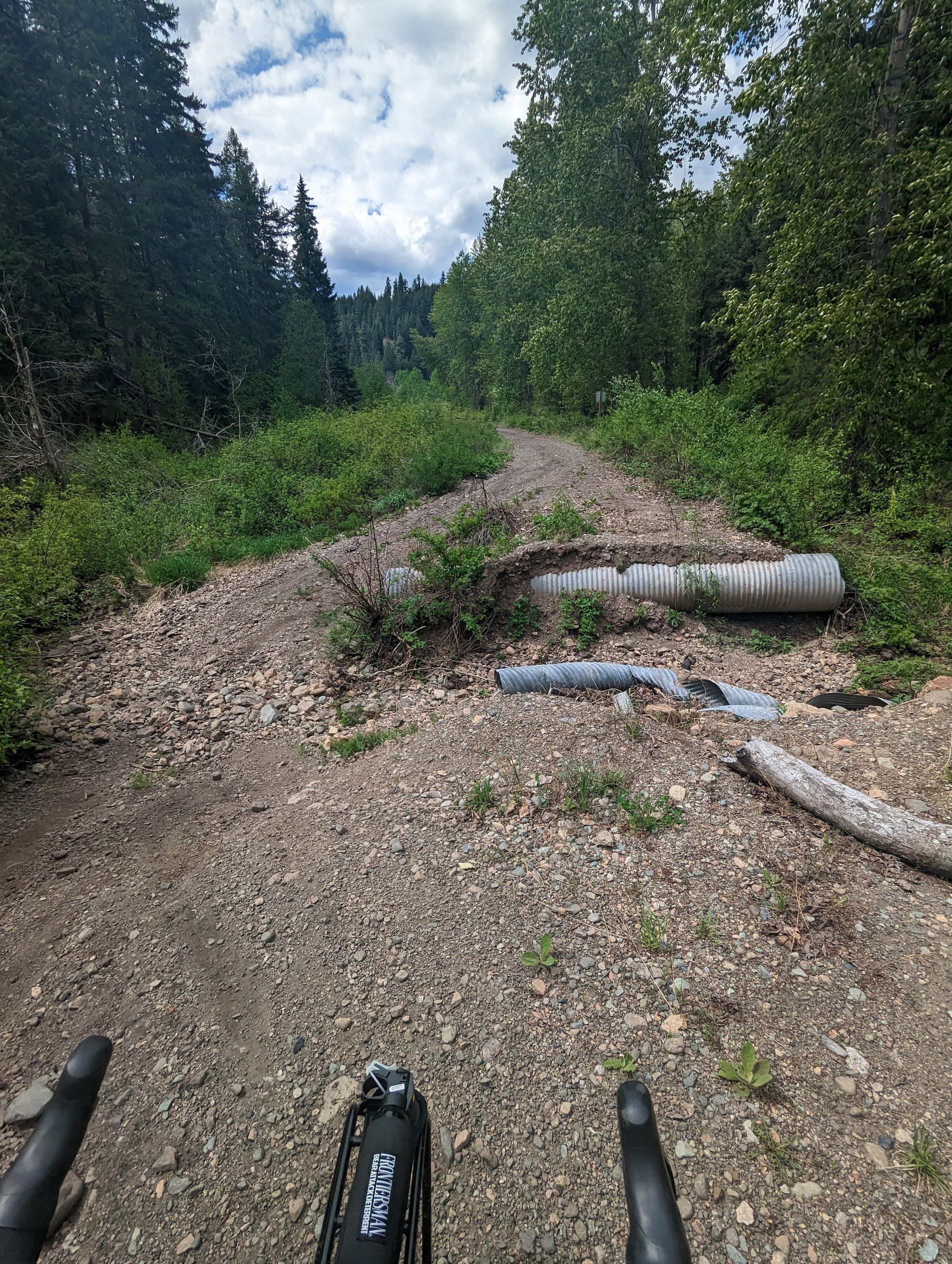
In the end, I was lucky and found no more. One minor washout where a culvert had been swept away was just a matter of a small bypass, and everything was easy after the 2 hour portage!
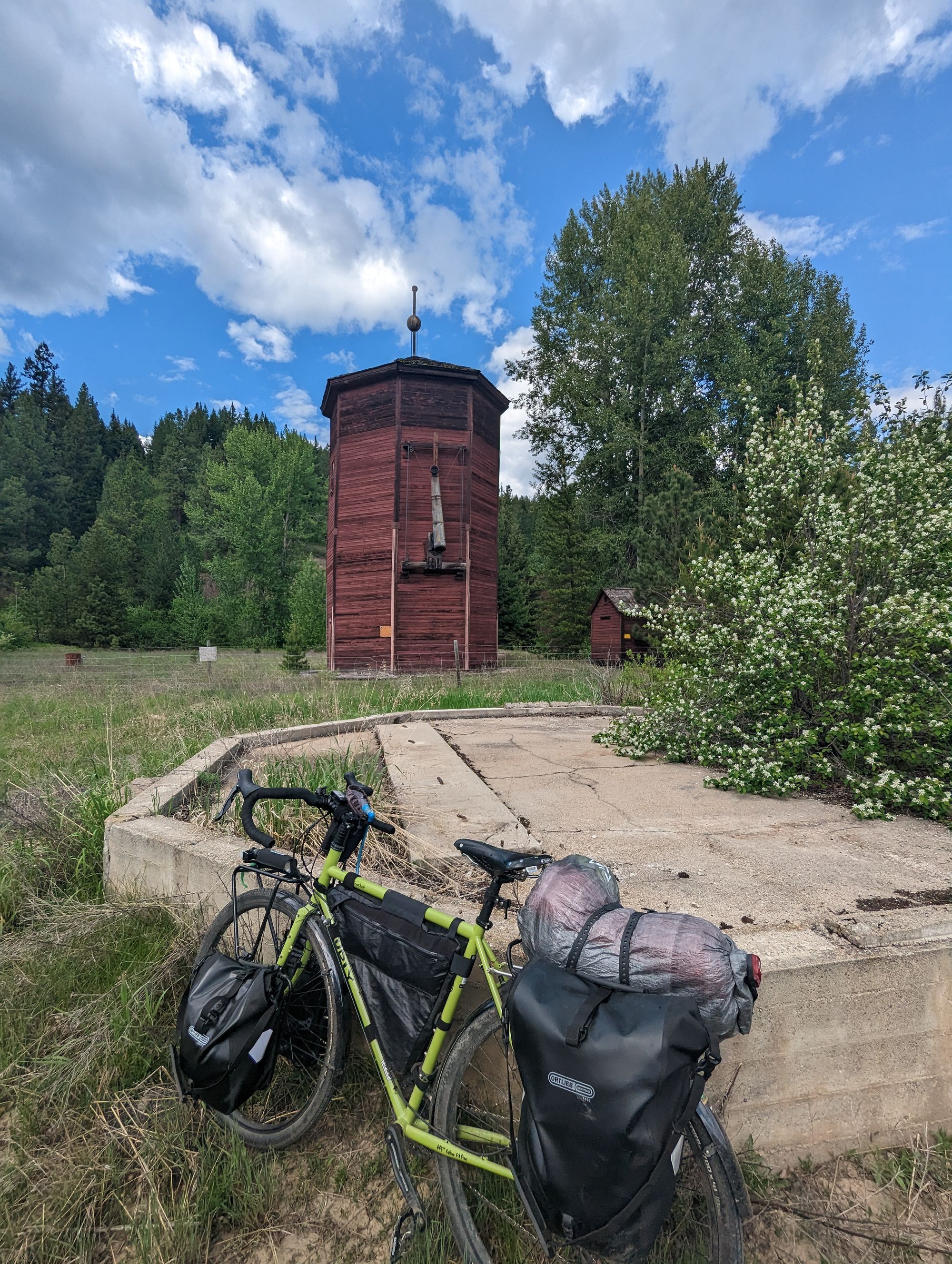
At about 4pm I found Brookmere. A collection of about a dozen houses, the town has no services. It does have one of the few remaining water towers on the trail however! A small reward for a very trying day. I was also right on the edge of cell service and managed to check in with my family, allaying their fears that I trapped inside the belly of some bear.

It was also decision time. My plan had been to try to follow the KVRT south from here to Hope,BC but after what I'd experienced I knew that the remainder of the trail existed only on paper. I was sure there was no way to use it any further. All the warnings about washouts, and missing trestles/bridges, and impassable terrain would be true.
My options were:
- Go North to Merritt and take highway 8 to Spence's Bridge, then take the TransCanada South to Hope...which would add about 2-3 days.
- Take the Coquillhala Highway South to Hope. This is the most direct route, but "The Coq" (pronounced "Coke") is notoriously busy and scary for bikes. The speed limit is 120 and people do 130 easy. I'd told myself I wouldn't ride it when I left Calgary. It was also 5pm now and I didn't want to risk being stuck on the highway at dusk.
- Find a way west through the mountains to Highway 1.
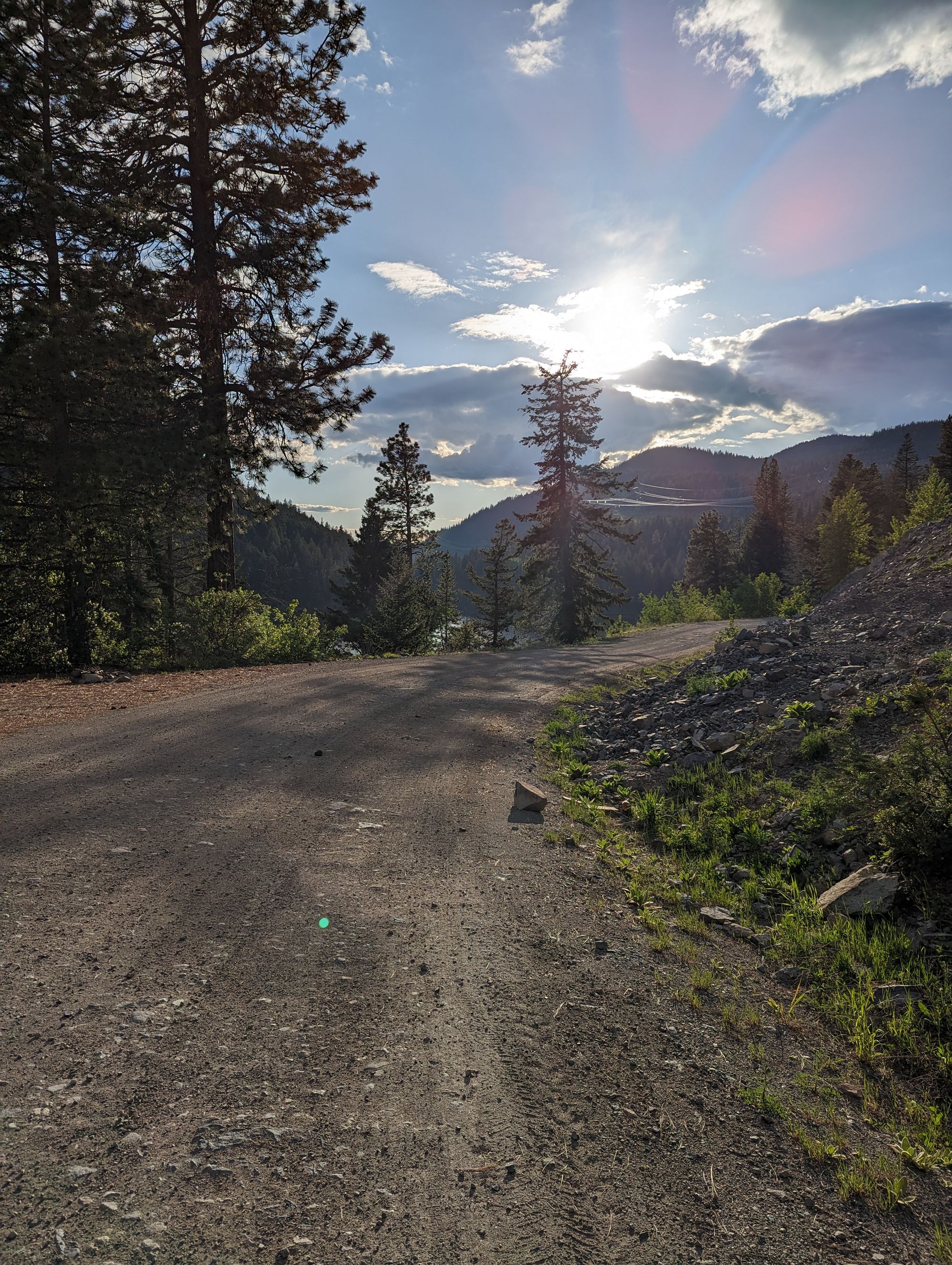
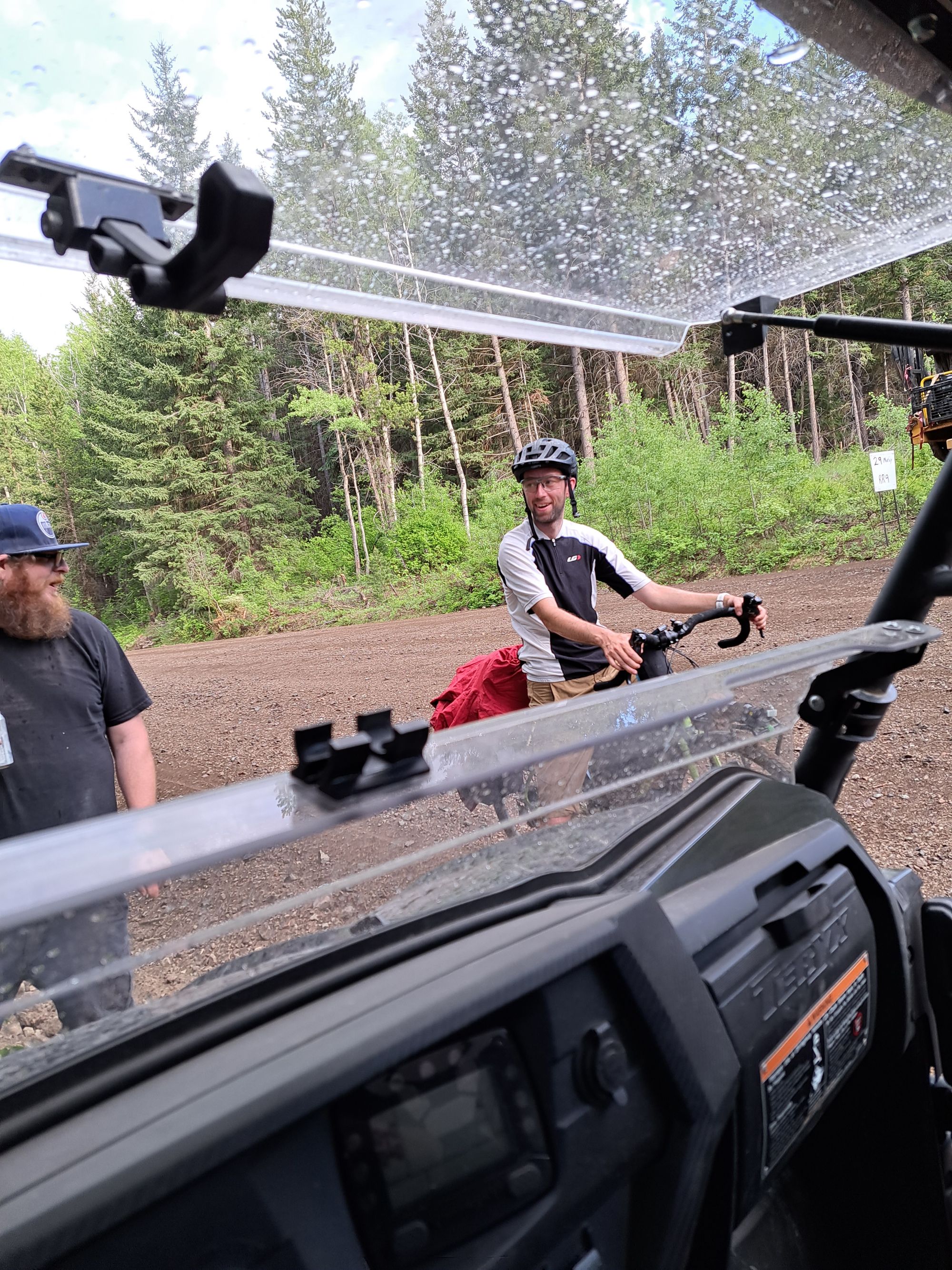
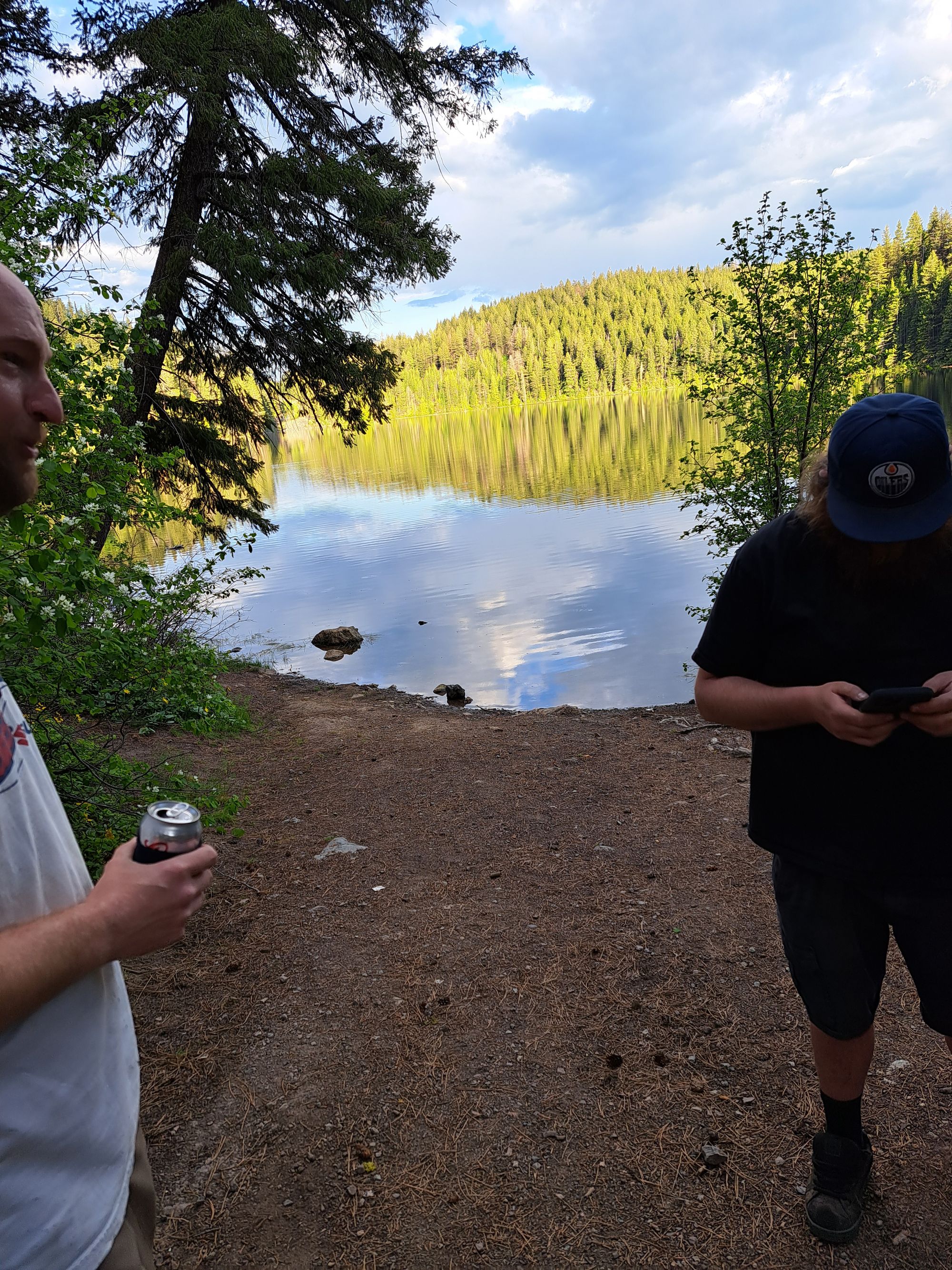
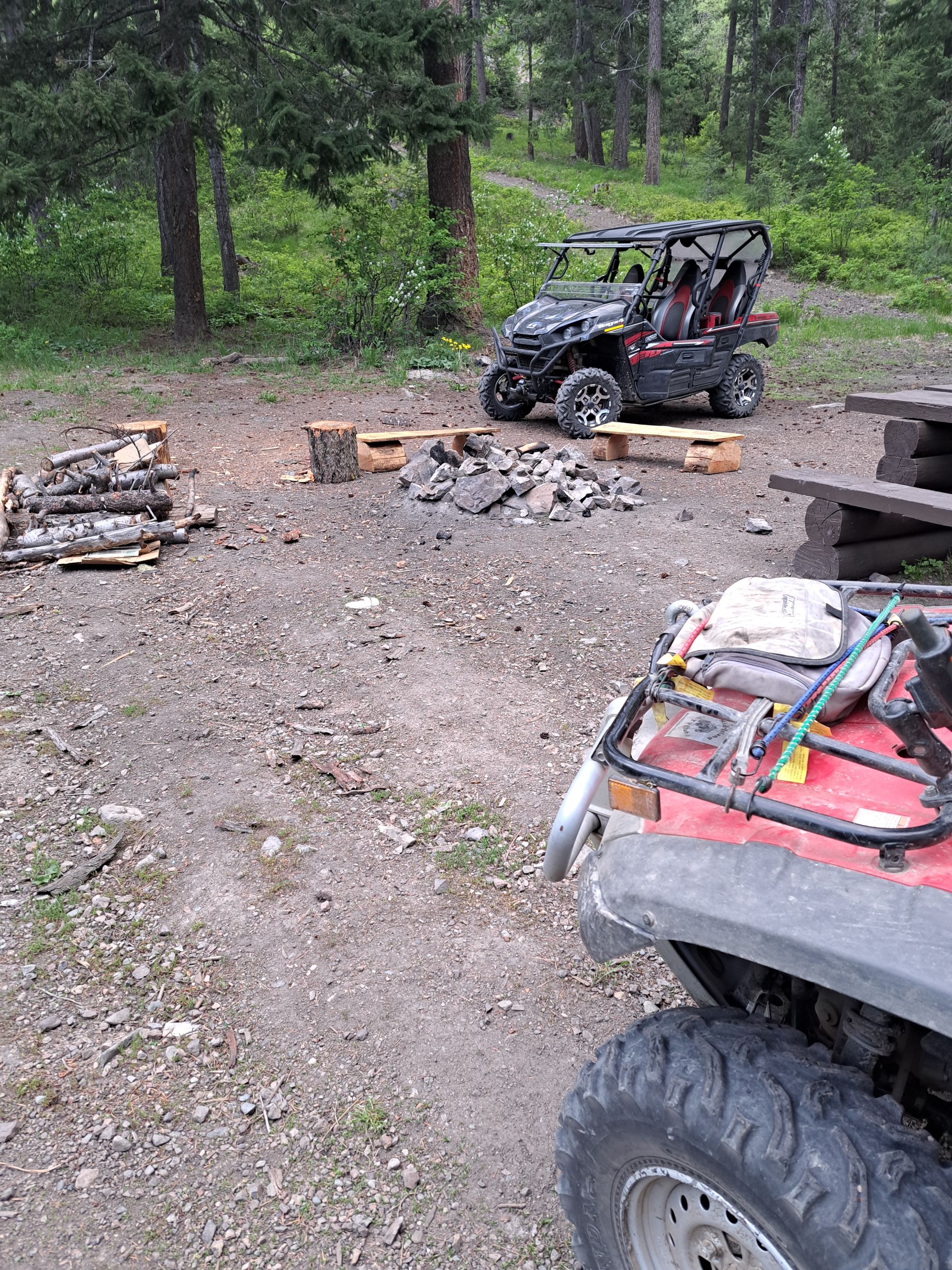
I did some research and found that option 3 was doable. There was even a campground along the way and close by. I opted for that. I peddled on pavement for the first time of the day and enjoyed myself. I found the road to the campground, and stopped to talk to some guys out for a rip on their ATV and side-by-side. They told me about the area and asked about my trip. They offered me a beer, but I felt I was seriously dehydrated and didn't take it. So they gave me a bottle of water which I greedily chugged down. They also gave me a small bag of beef jerky. These guys were my saviours.
They warned me that there were a lot of hills to get to Gillis Lake campground, and they weren't lying. Over 6km I needed to climb 400 meters. I started off pushing because I was already gassed. At some point it rained while I climbed. Long story short, it took almost 1.5 hours to push up the elevation and I invented several new swears to describe the experience. The water was pouring off me - both sweat and rain - and once the rain stopped the mosquitoes found me again. It was sheer madness.
I eventually reached the campsite. Drenched in sweat. I could smell myself. And waiting for me were my three saviours. And this time I took the beer. A Coors Light, it was the sweetest mountain nectar. I never got a picture with them, but their names were Jamie, Rudy, and Mike. Thank you for the help yesterday Boys, I think you saved me twice!
UPDATE: Jamie, Rudy, and Mike started following the blog and sent me some photos! Thanks to Mary for sending them along!
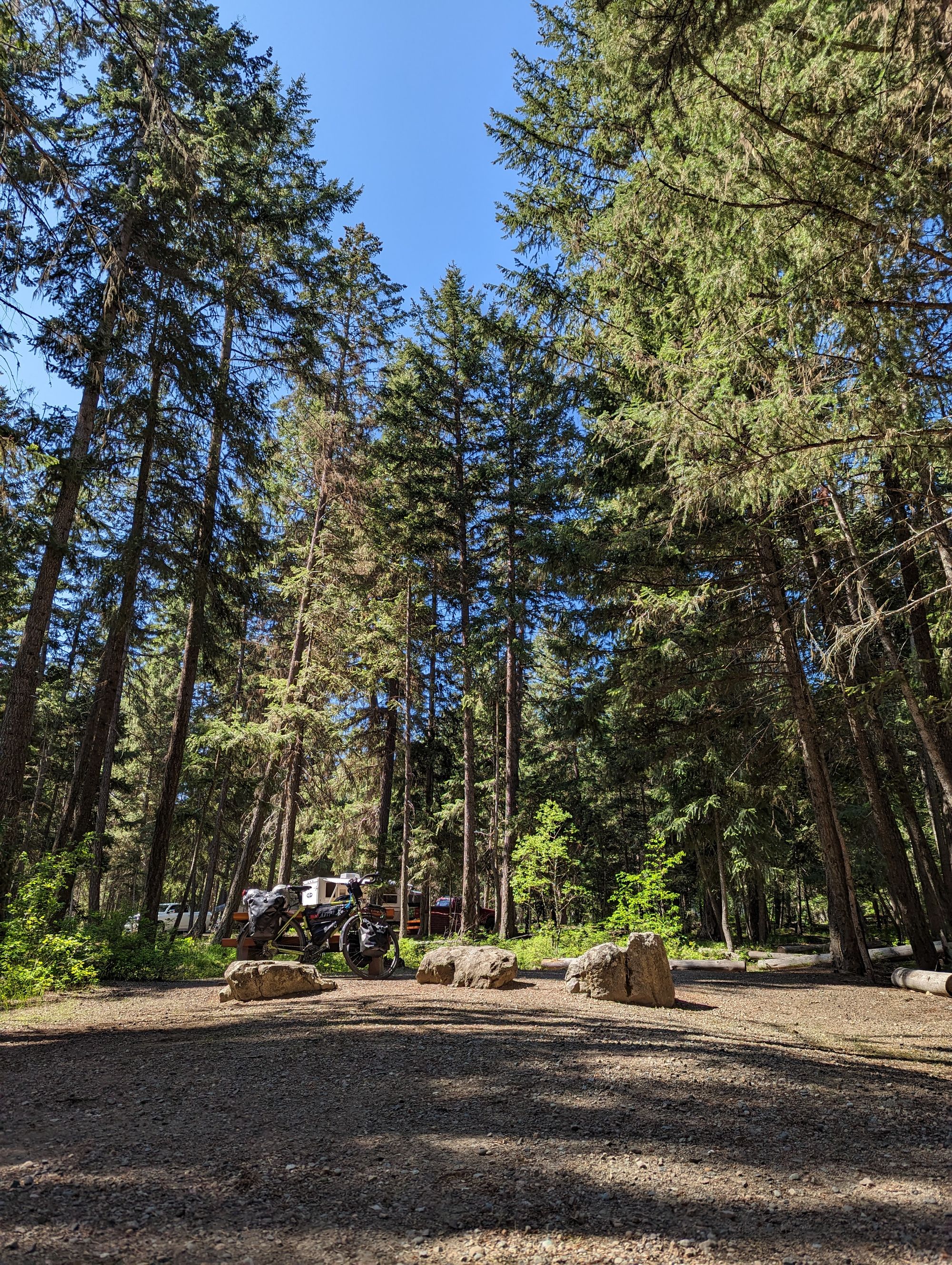
I setup my camp and made dinner (instant mashed potatoes...my favourite). A solo loon came out on the water and sang its mournful song. It had only been 50km but it was the most intense and adventure-some that the trip had been so far. My bike odometer said I'd gone 50km. My Strava said 53km. Which means I did 3km of fording/portaging! I promised myself that if I ever found highway again I'd kiss it and never leave it.