Day 29: Gray Creek, BC -> Kimberley, BC
Jeremy reaches the highest point of the trip, and races a storm to Kimberley

Date: Tuesday, June 13, 2023
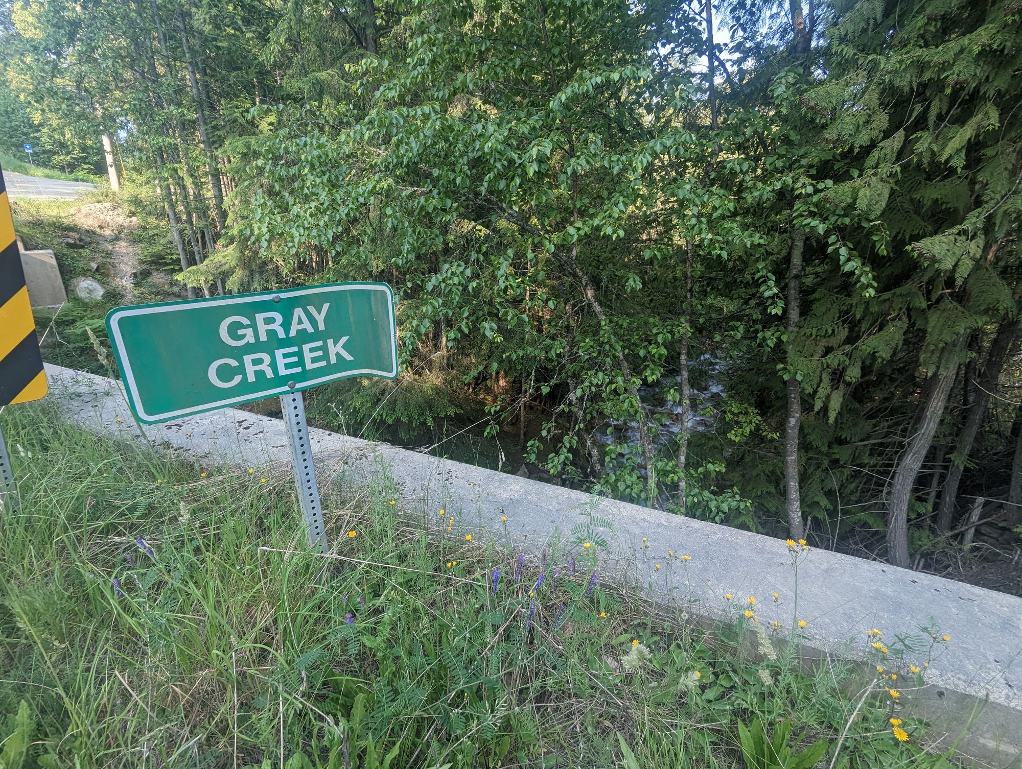
Start: Gray Creek, BC (Gray Creek Camping Resort)
End: Kimberley, BC (Kimberley Riverside Campground)
Distance: 81km
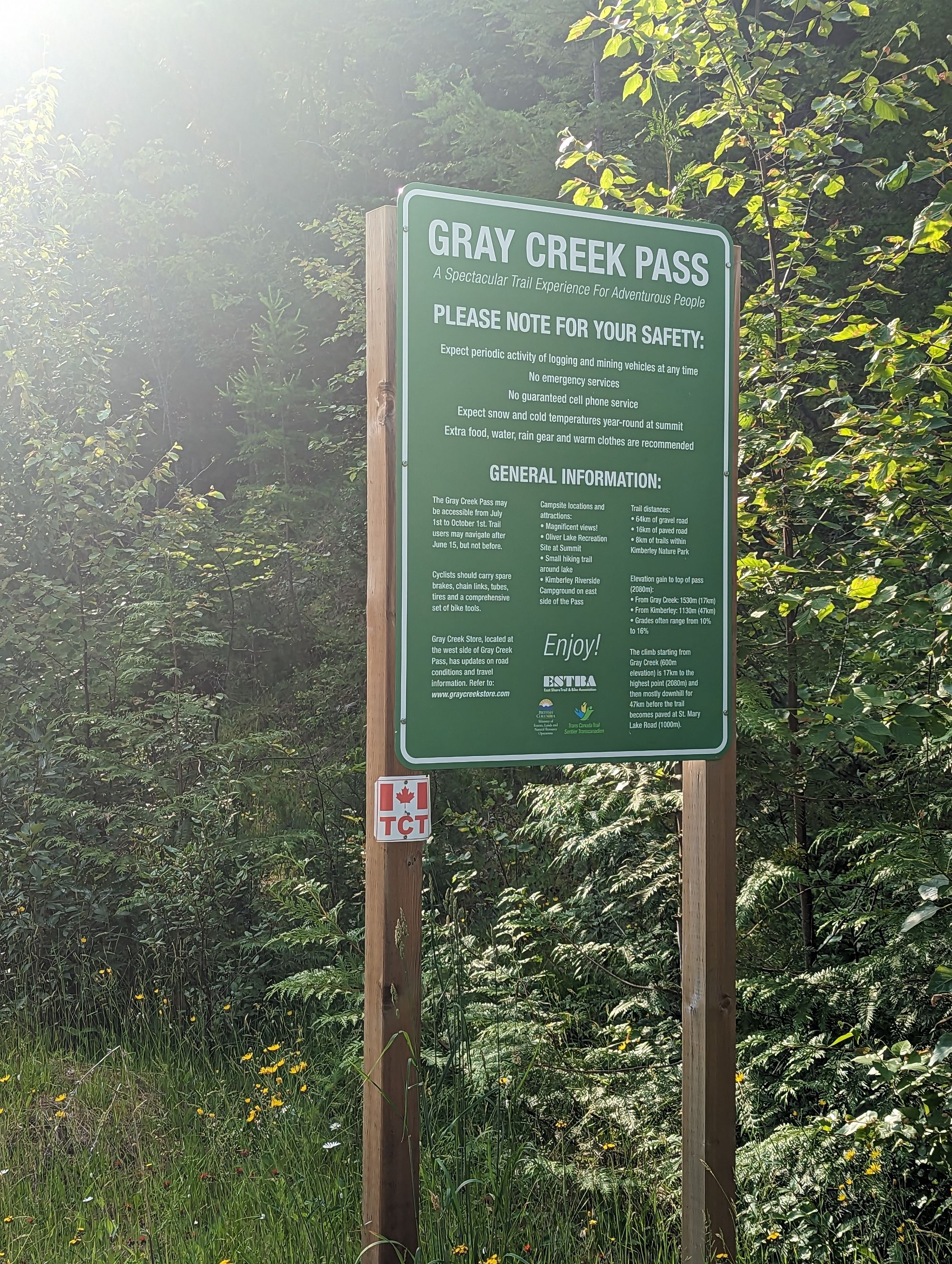
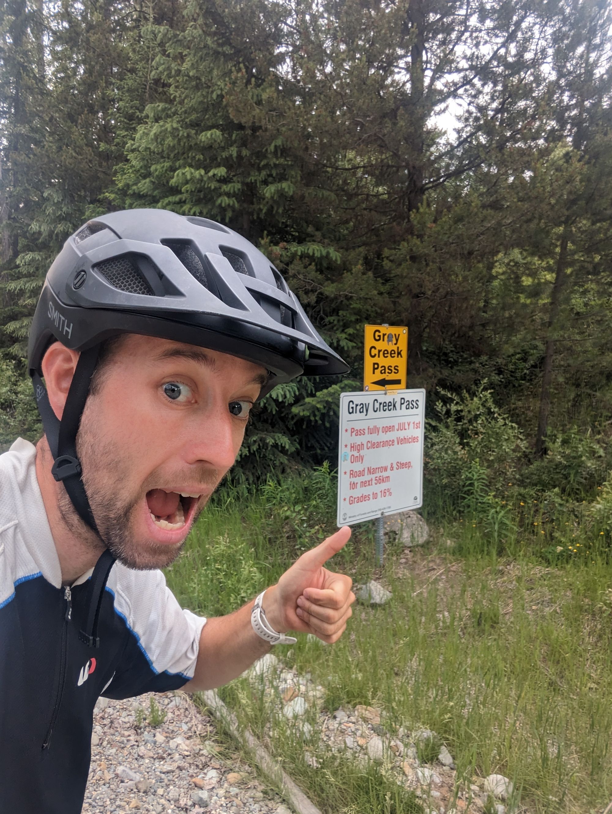
Today was the day. When I started planning the BC portion of the trip, Gray Creek Pass was a spot that I'd researched and thought a lot about. It's technically part of the Trans Canada Trail, aka The Great Trail, or if you've been following this blog...THE TRAIL OF LIES! It was created in 2017 by stringing together a lot of small trails to create a coast-to-coast bike path except it failed in so many ways (including designating Lake Superior as a "water trail"). ANYWAY...Gray Creek Pass is part of the the Trans Canada Trail (TCT), and I'd read about it from others who have done it.
Gray Creek Pass can be snow covered up until July. For this reason, it's not recommended that anyone cross it before then. I'd talked to two people who had some it by motorcycle a few days before though and they said it was clear (though they thought I was insane to want to do it on a touring bicycle). As there hadn't been any serious rain since I'd talked to them I could be fairly sure it was still clear. Also, I'd camped beside Dan who was also planning on doing it.
I'd read the blog of someone who had tried it last year at almost this exact date and had to turn back. The trail wasn't snow clear till almost mid-July last year. Here's a picture of that guy trying to push through the snow last year (note he has the same bike and a similar setup!)
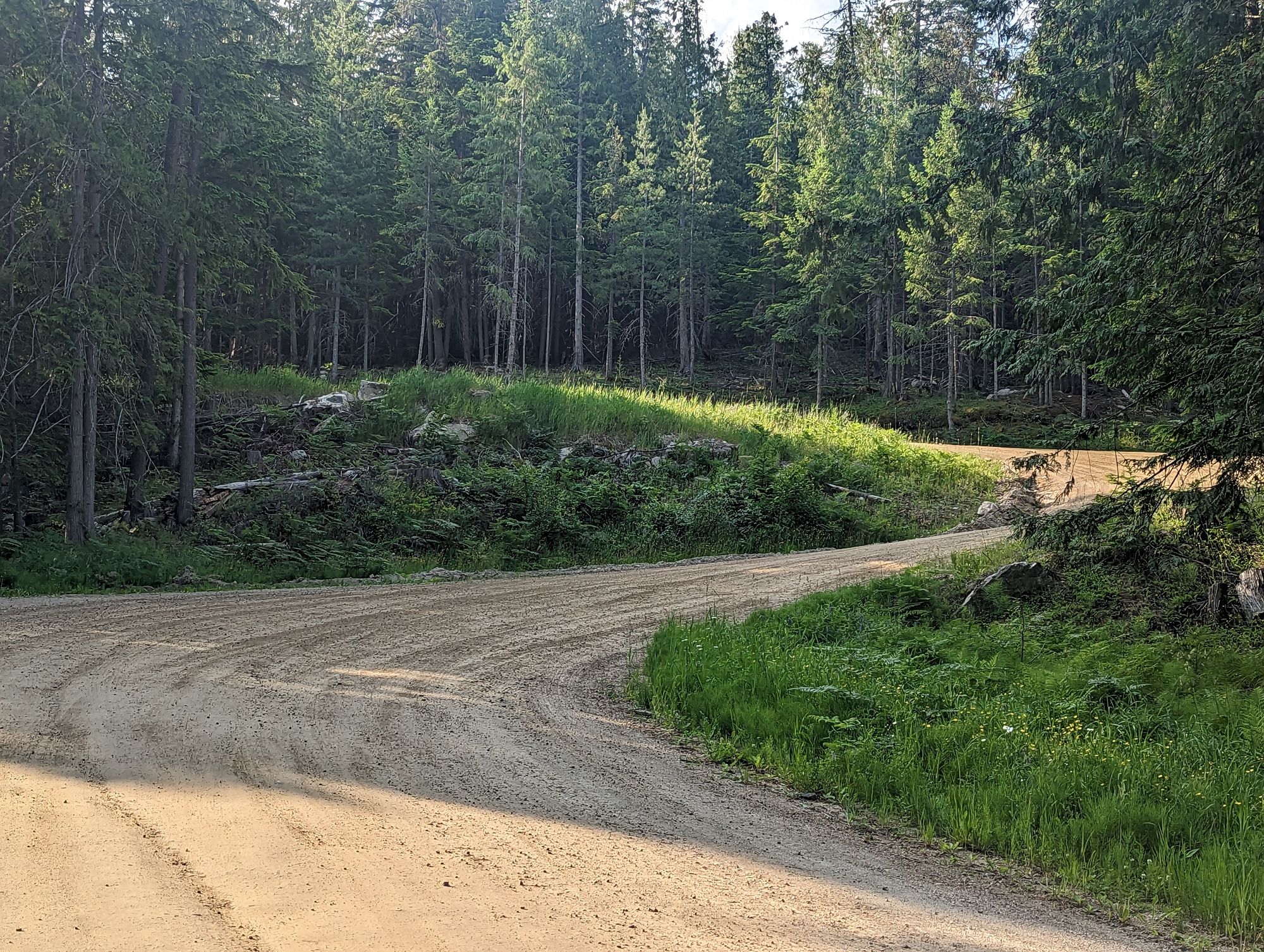
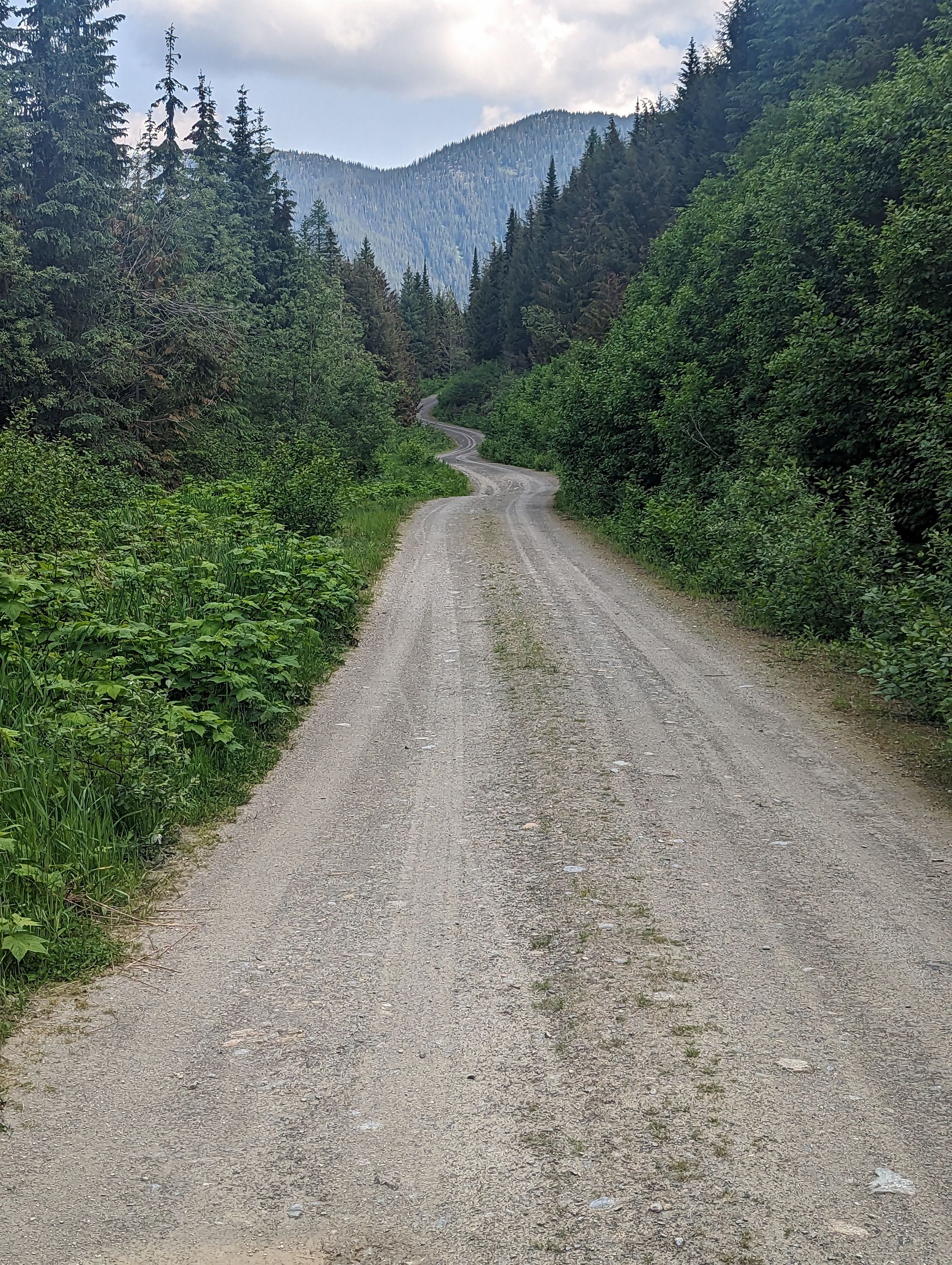
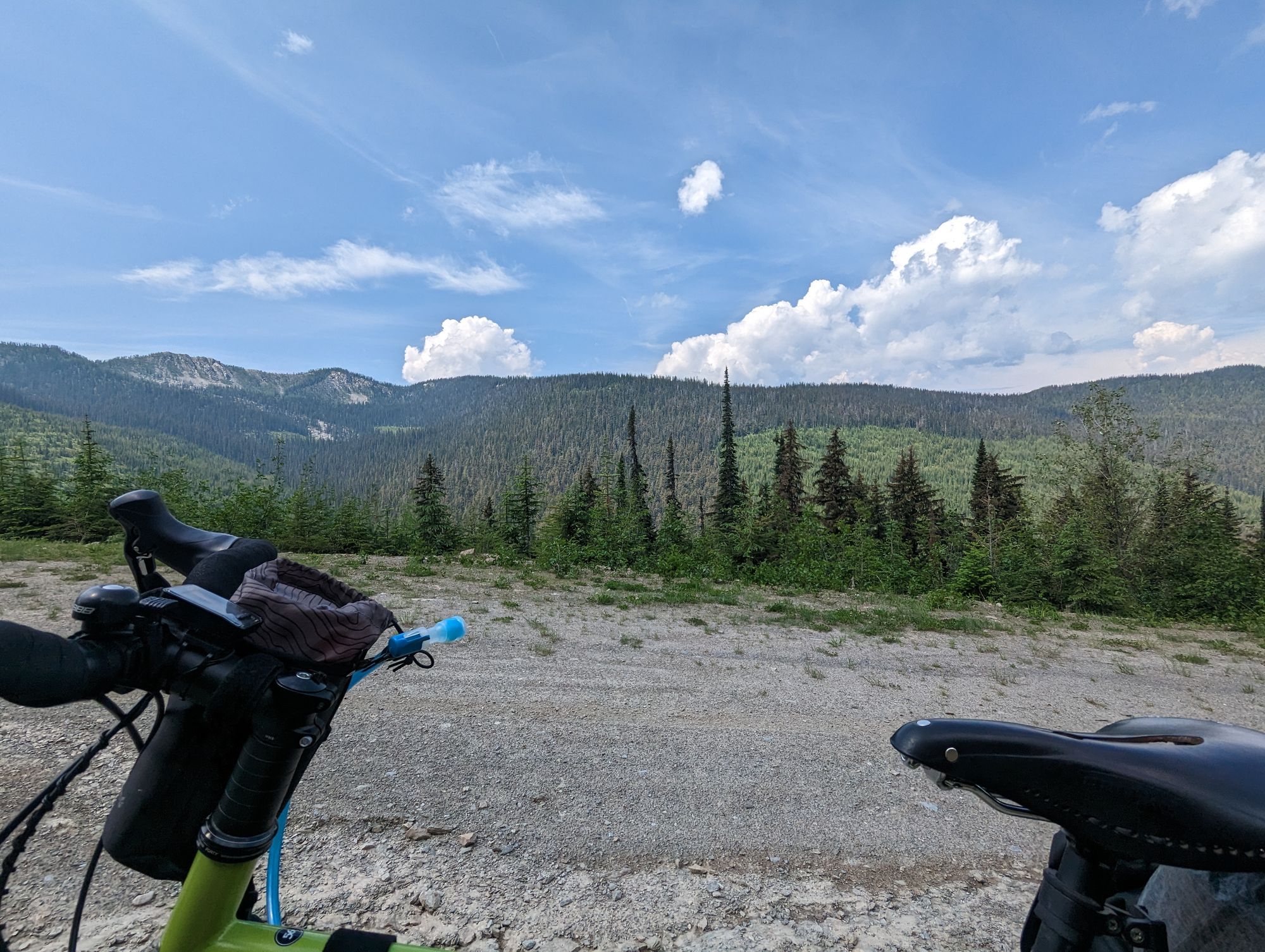
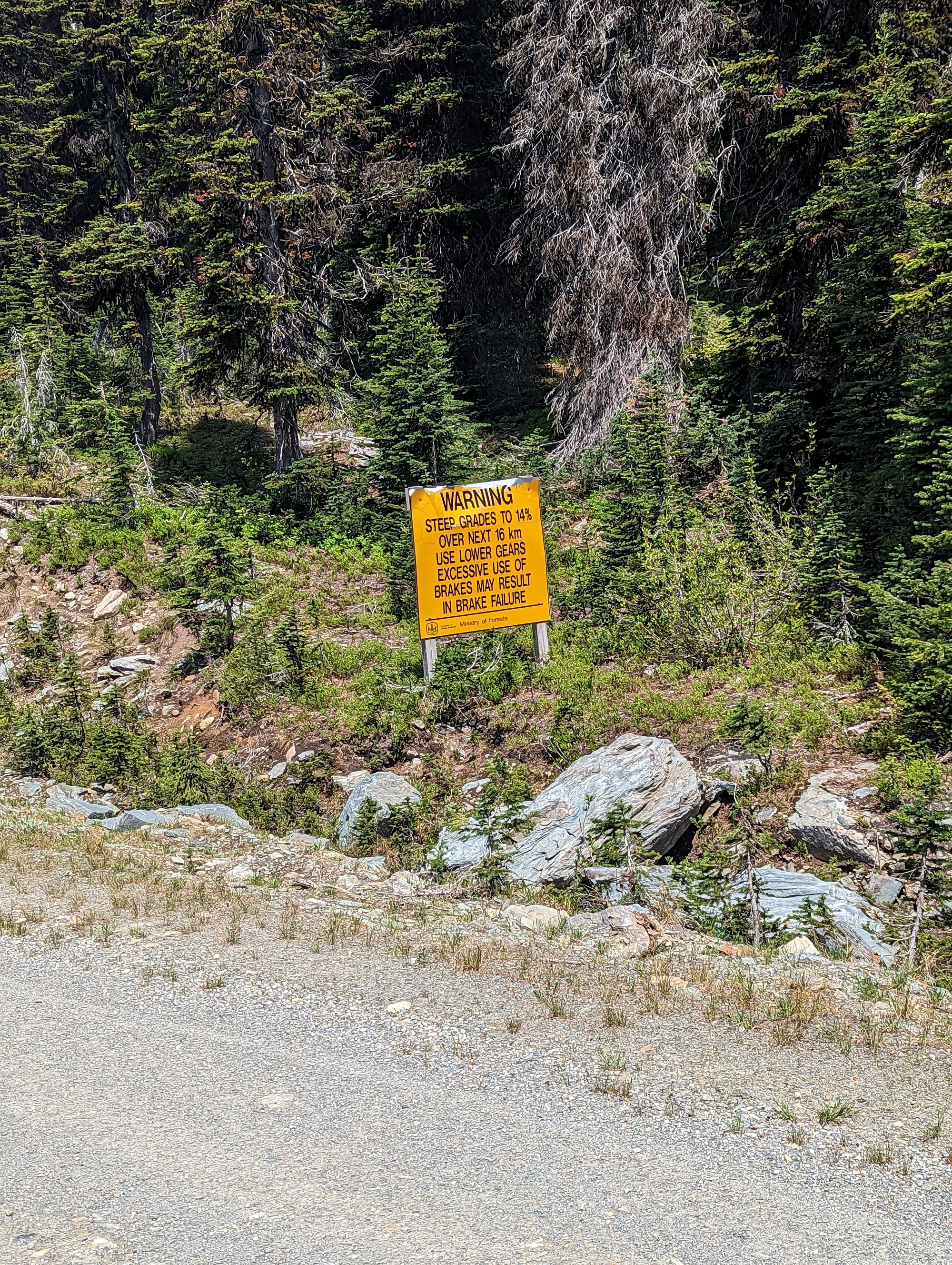
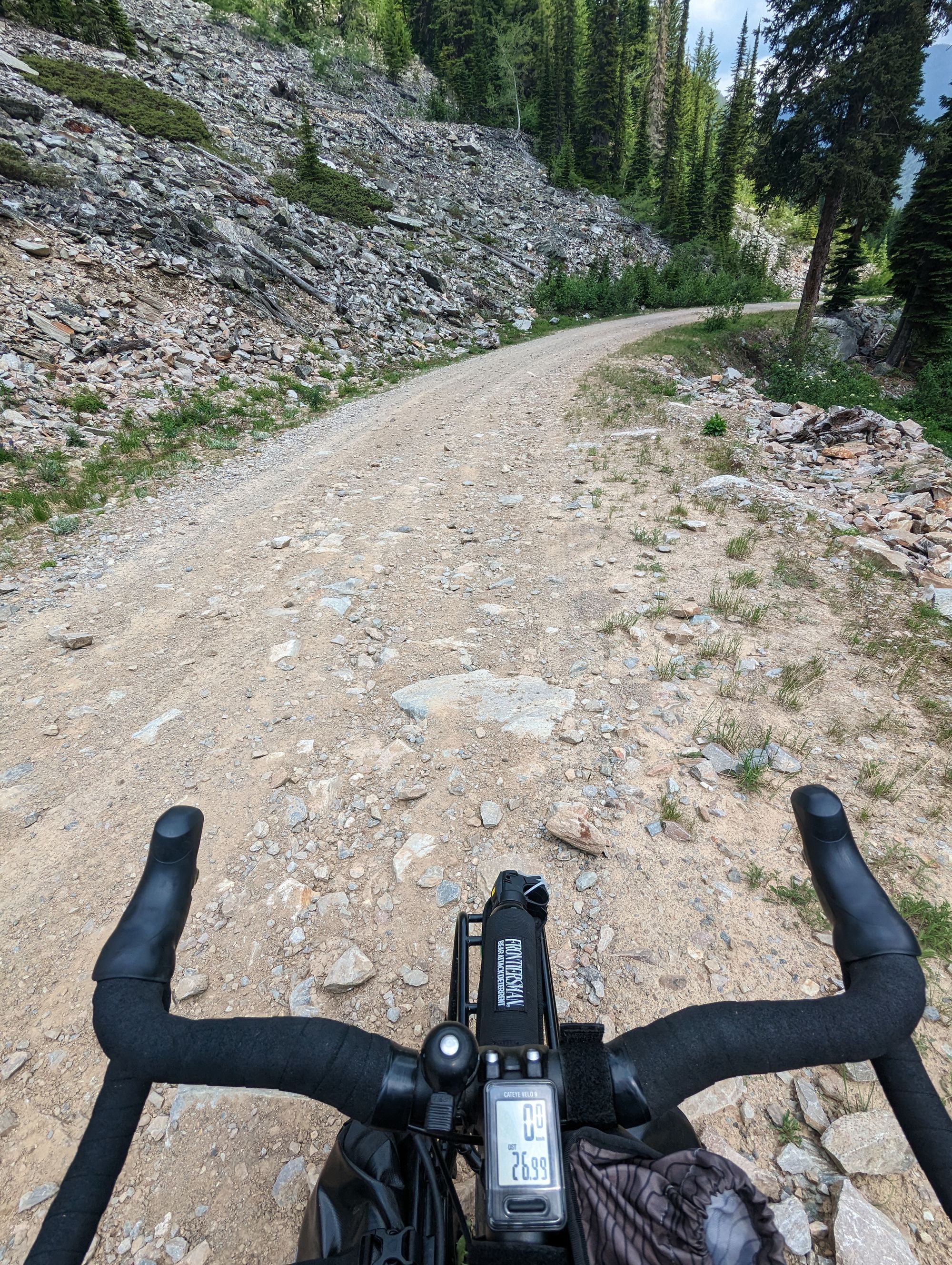
Going over it would mean climbing to the highest elevation of the entire trip! 2083 meters (6833 feet) above sea level! The climb itself is 1524 meters (exactly 5000 feet) over 16km going west from Gray Creek to Kimberley. It's the 10th highest road in Canada. It's an absolute monster. So of course with the threat of rain in the afternoon, and a bike that was ill suited to the rough forestry road...I decided I was going over it!
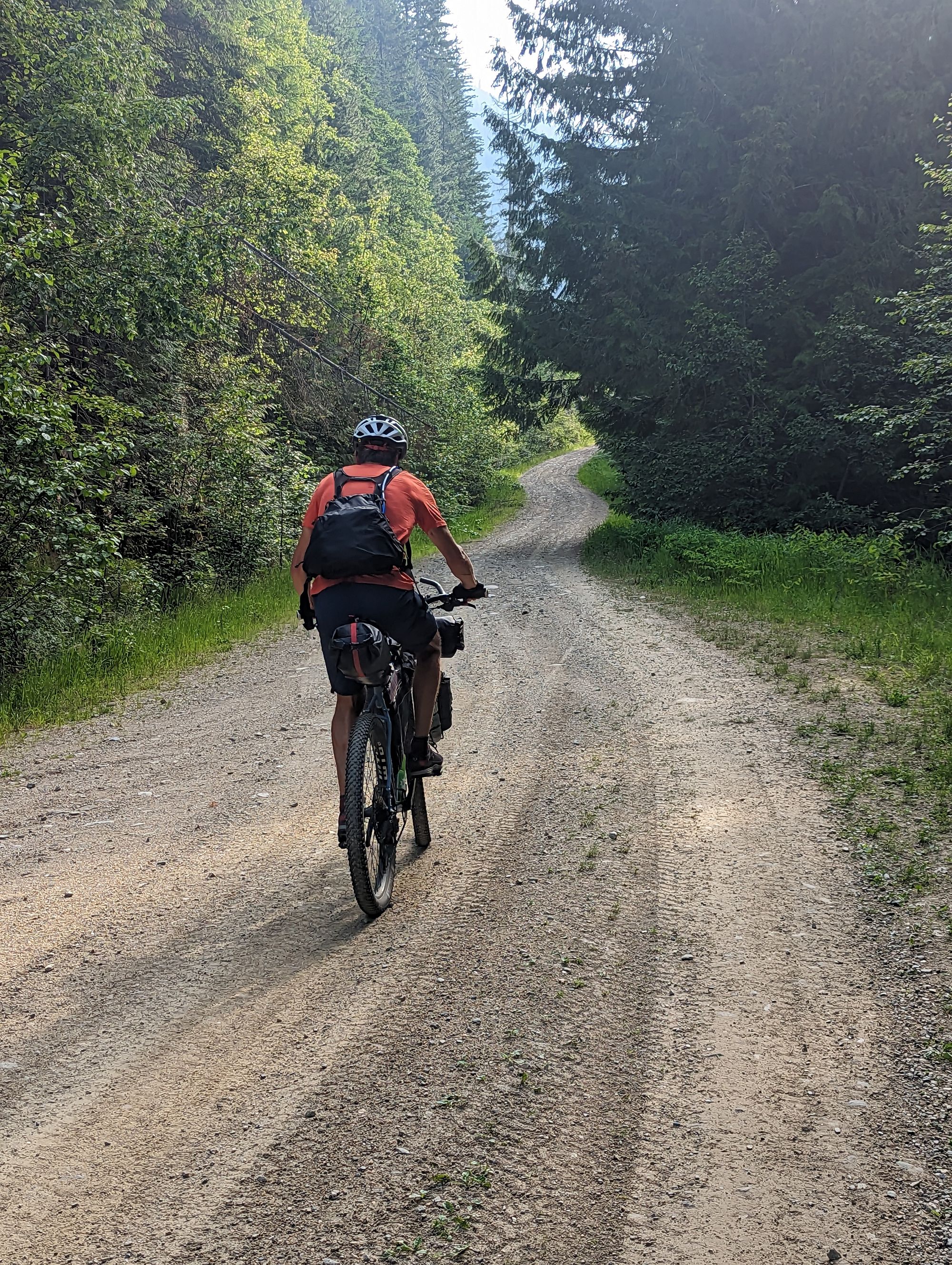
Dan and I paced each other in the morning as we tried to get off as soon as we could. We wanted to maximize the available time to get over the top as well as try to beat the rain. By 8am we were both ready to go.
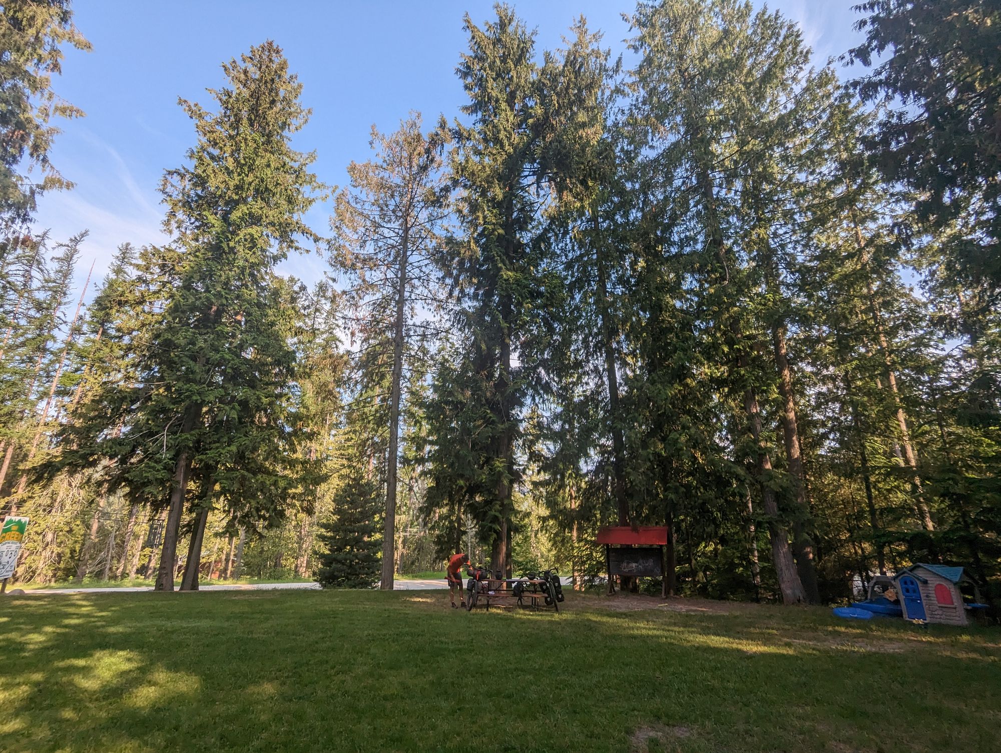
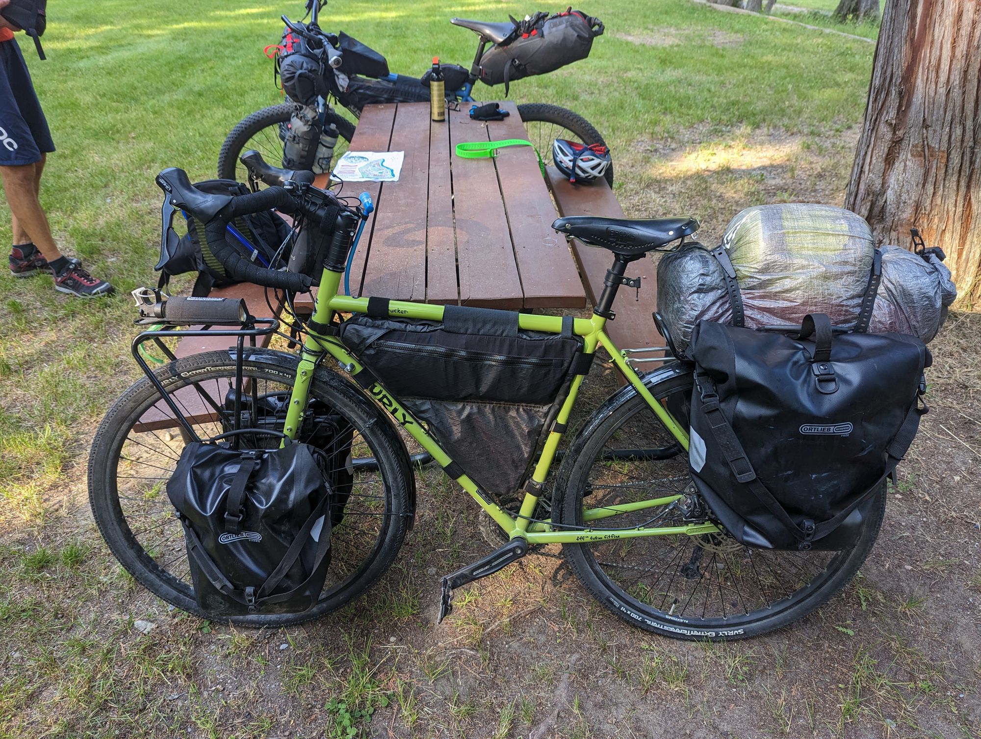
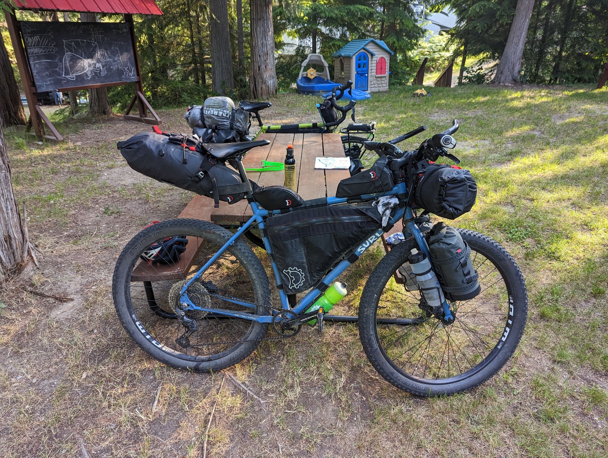
Dan and I had completely different setups. Dan ALSO has a bike built by Surly, but it is their mountain bike touring model. His setup is closer to what is called "bike packing" which is basically the bike equivalent of hiking. I have Surly's touring bike which is more the bike equivalent of...whatever hiking on paved roads is. His bike had better tires for the rough mountain roads and his gearing is better suited for the climb. He also had less gear. He'd be able to go up and down faster than me. Here are two photos to let you compare:
I set off about 10 minutes before Dan. After 20 minutes of biking, he passed me. I watched for about 30 minutes as he gained distance away from me. At one point he turned a corner and - like so much morning dew - he disappeared into the morning and I never saw him again.
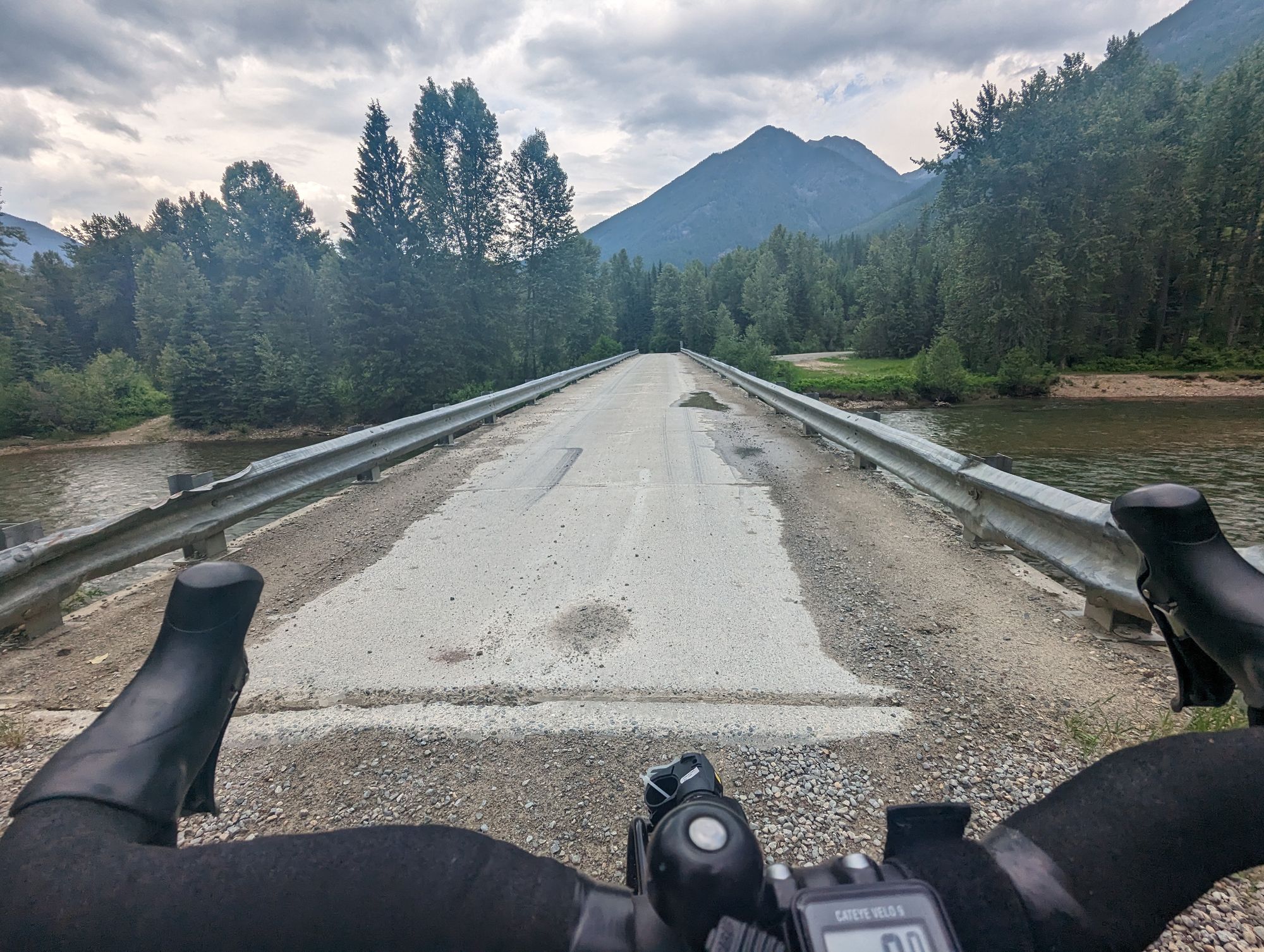
I can remember the hardest physical challenges I've done. There was a climb on The Long Trail in Vermont that still takes the cake and I remember it well for how difficult a day it was. This rivaled it, and might have even matched it for difficulty. I kept switching between biking and pushing the bike. It was the same as the day I'd tried to push across the forestry road from Gillis Lake and been rescued by Robert the bear hunter. The road was rock and stone, and would go from road to trail to path at times. I could try to go on about it, but it was one of the most difficult physical things I've ever done - compounded by days of major road climbs the previous days - and I stopped frequently to consider my life choices. I was passed by two people on touring motorcycles heading up the road.
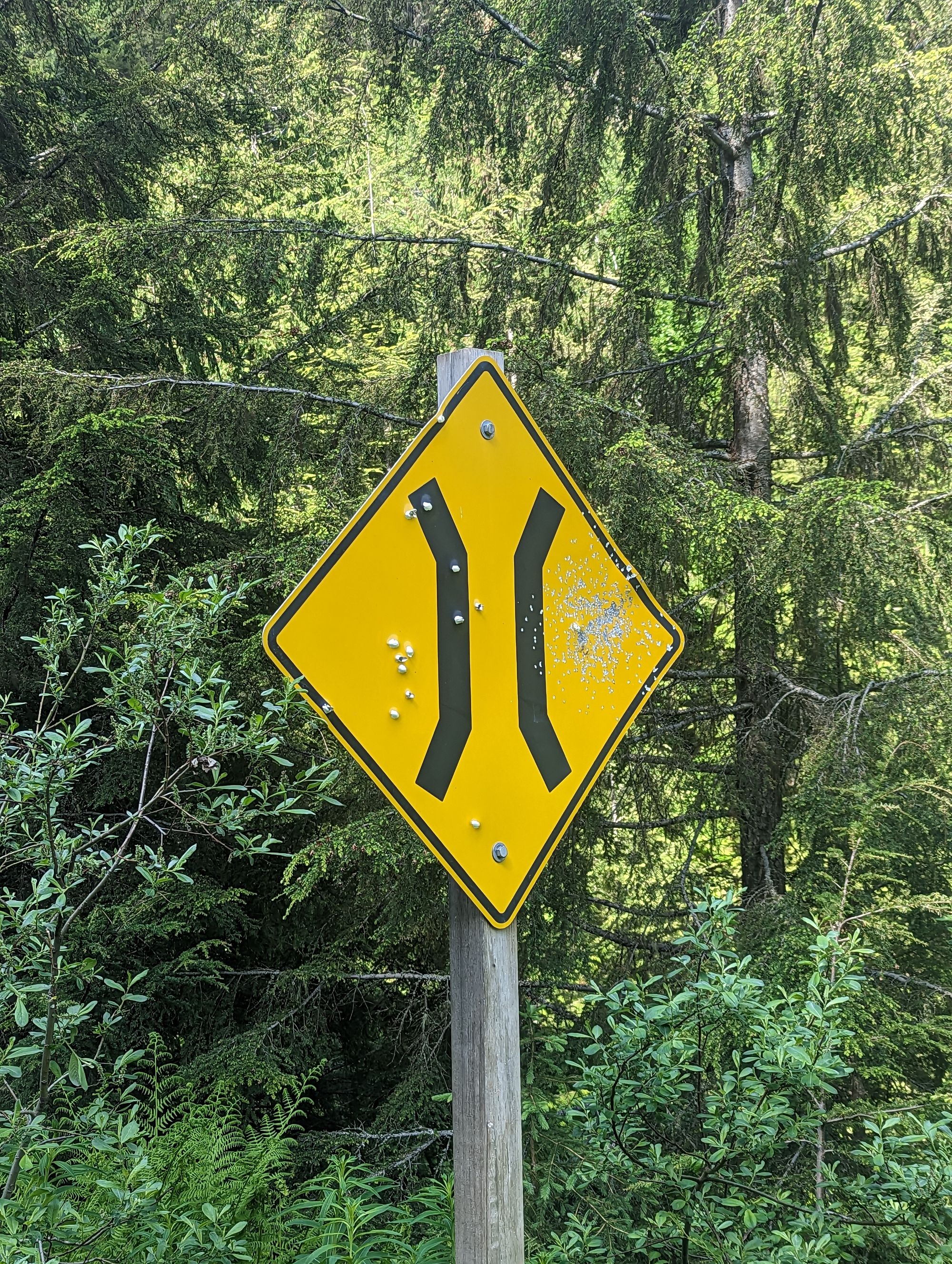
I passed signs marking small bridges along the road. They'd been shot up. The Stuart Index (measuring proximity to major population centers based on the number of bullet holes in roadway signs) was the highest value yet.
I watched as the odometer on my bike computer slowly ticked up. I had planned for it to take at least 4 hours. I played podcasts on my phone. I wanted some noise so bears could hear me coming, and I didn't want headphones to distract me from whatever might be around. It worked I guess, because I never saw any bears!
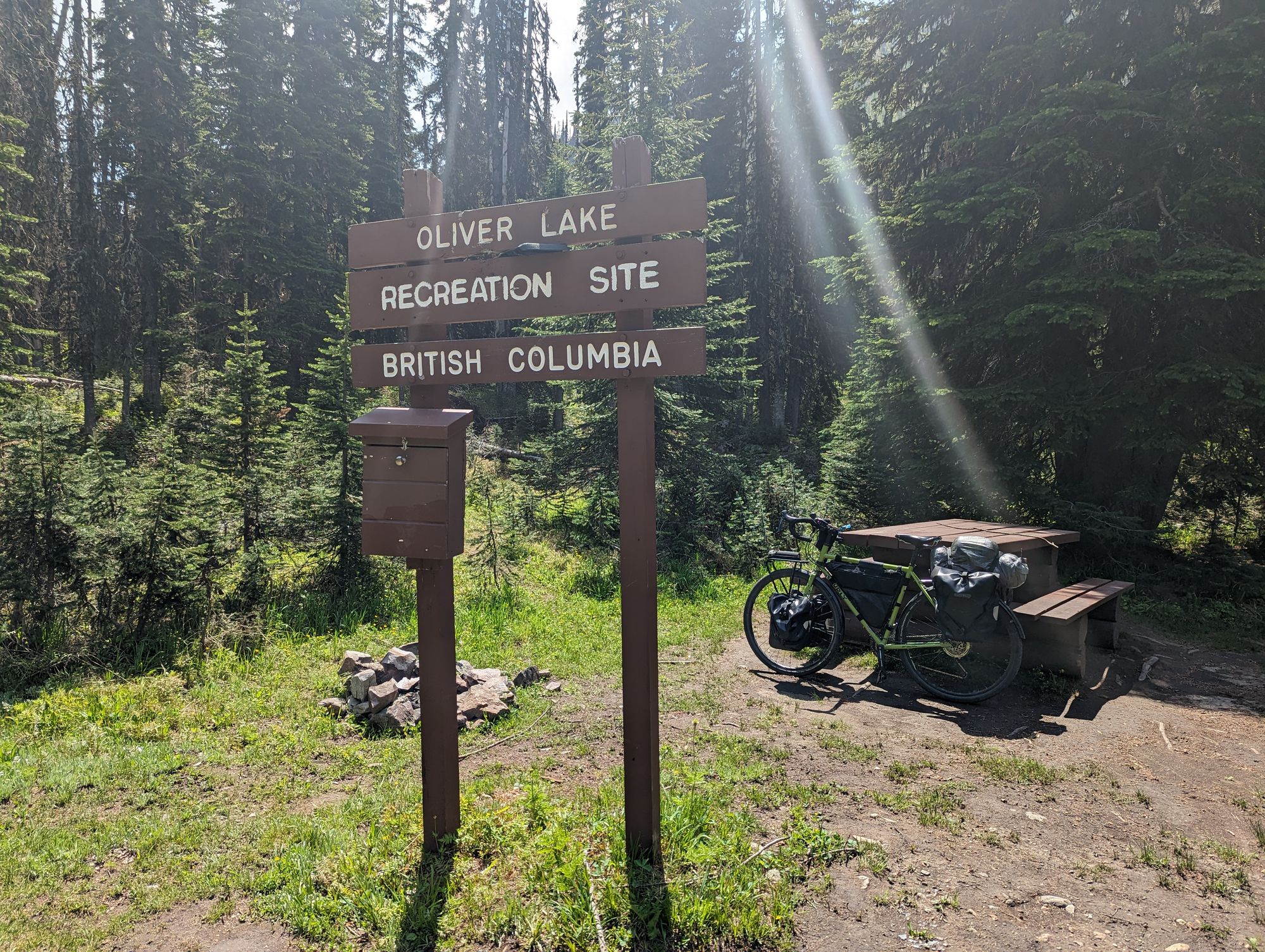
After 4 hours I reached the Oliver Lake Recreation Site that marks the - almost - end of the climb. I stopped for lunch, not wanting to bonk or overshoot and collapse. It was sunny and pleasant. I took 30 minutes to cool off, eat, and enjoy the scenery. I noticed that it'd been 4 hours, I had left at 8am, but the time was 1pm on my watch. I raised an eyebrow and realized that it would only be too fitting if I'd cross back into the Mountain Time Zone today.
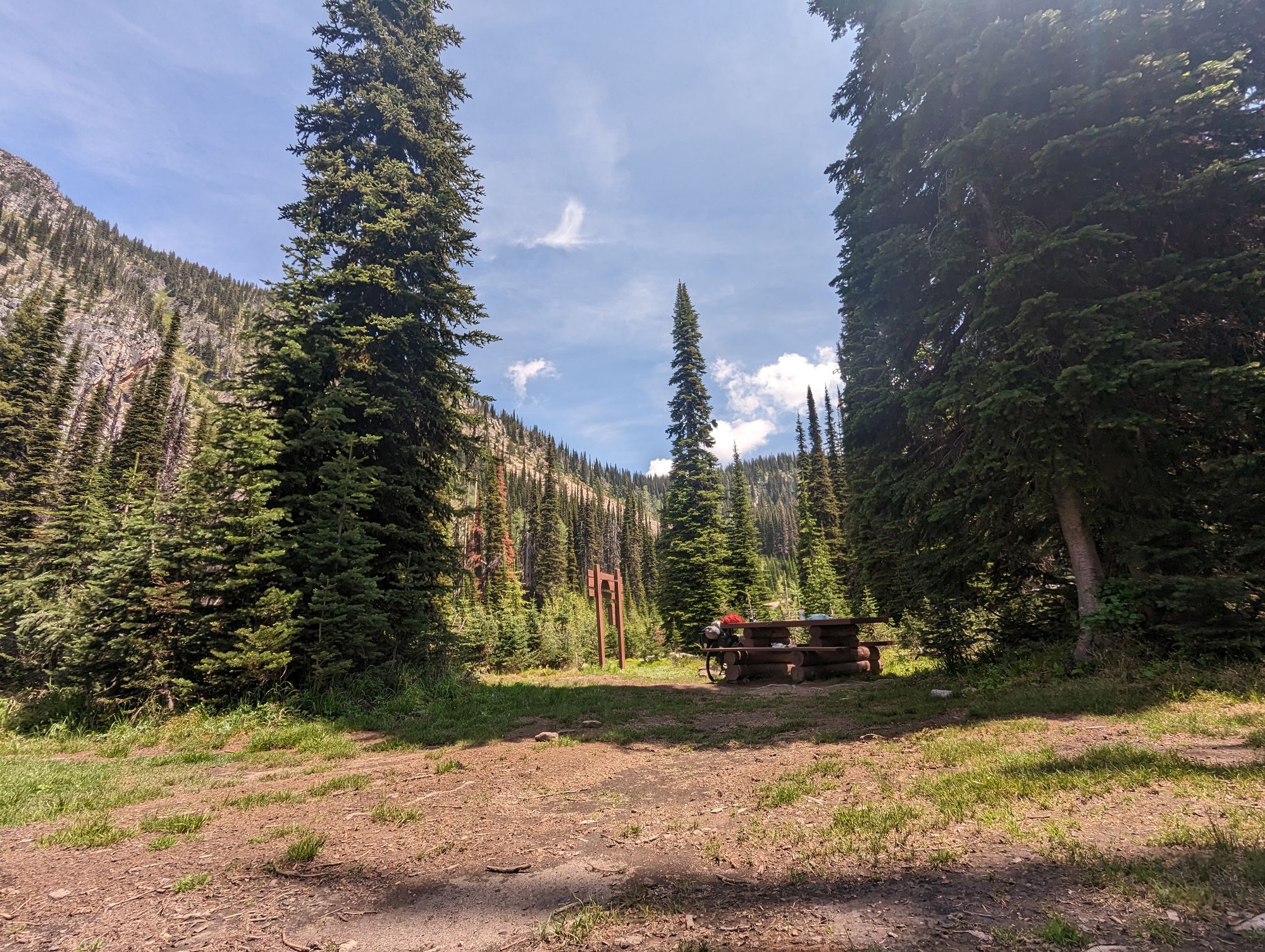
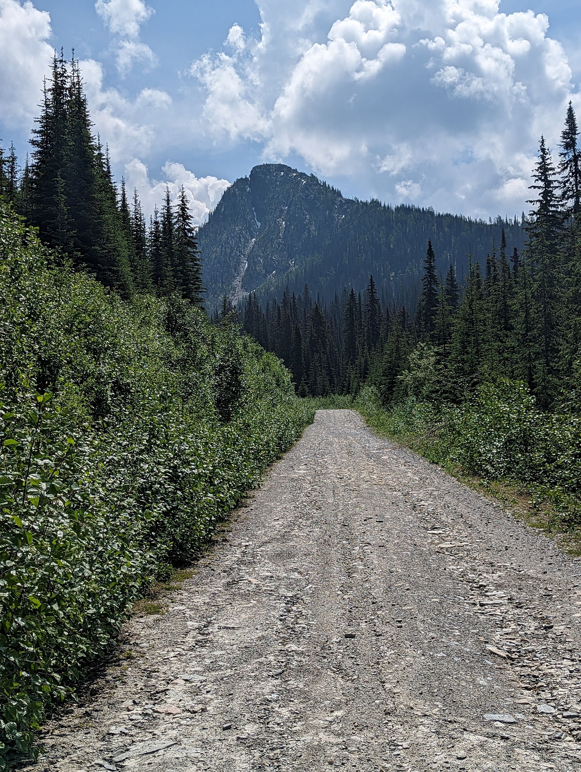
I had to climb another 1km before I reached the peak. There were patches of snow around. I found a sign that warned people about the downhill section they were about to start and knew I must be at the top! It was my turn to go downhill now. It was almost 2pm and I'd done just shy of 20km. I'd need to be diligent to get the next 50km-70km to get to Kimberley.
But I couldn't go quickly. The road was INCREDIBLY rough. I refused to walk however, and even if slow I rode the brakes down hill.
It was mentally exhausting, because it required all my attention. Peddling on highway is a pretty passive process and almost meditative at times. This road required me to constantly calculate the most immediate path that wouldn't bounce me over big rocks. I failed frequently and bounced a lot.
My bike held together brilliantly though, and I was happy to have paid for the proper gear. I ate banana chips for stamina. I was almost out of water, but mountain streams were all around and I drank directly from a stream that hammered down the rock and over mosses.
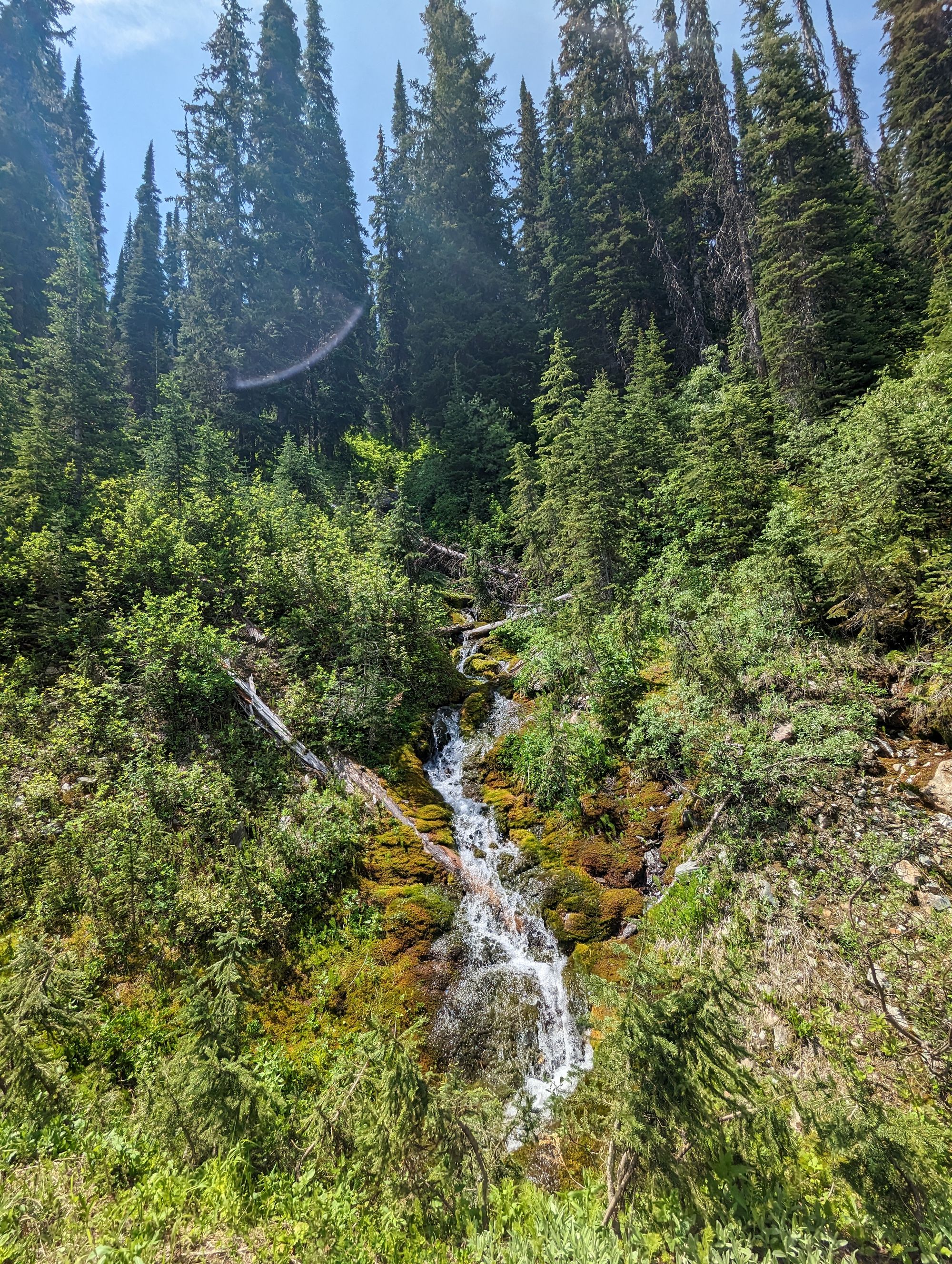
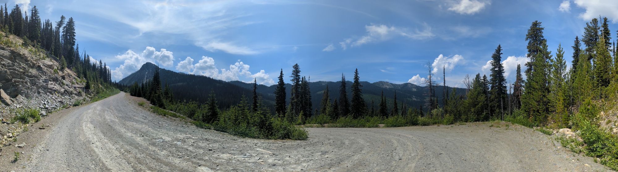
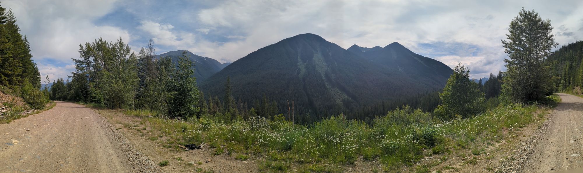
I saw the giant patches on mountain sides where logging had cleared out the older growth and replaced it with greener, younger trees. It occasionally would rain on me, but never more than a minute or two. Just enough to cool me.
It was a long time. I biked and biked, making somewhere between 10-12km/h. I could hear occasional thunder behind me as the storm I'd seen predicted started coming over the mountains and through the pass itself. I peddled on.
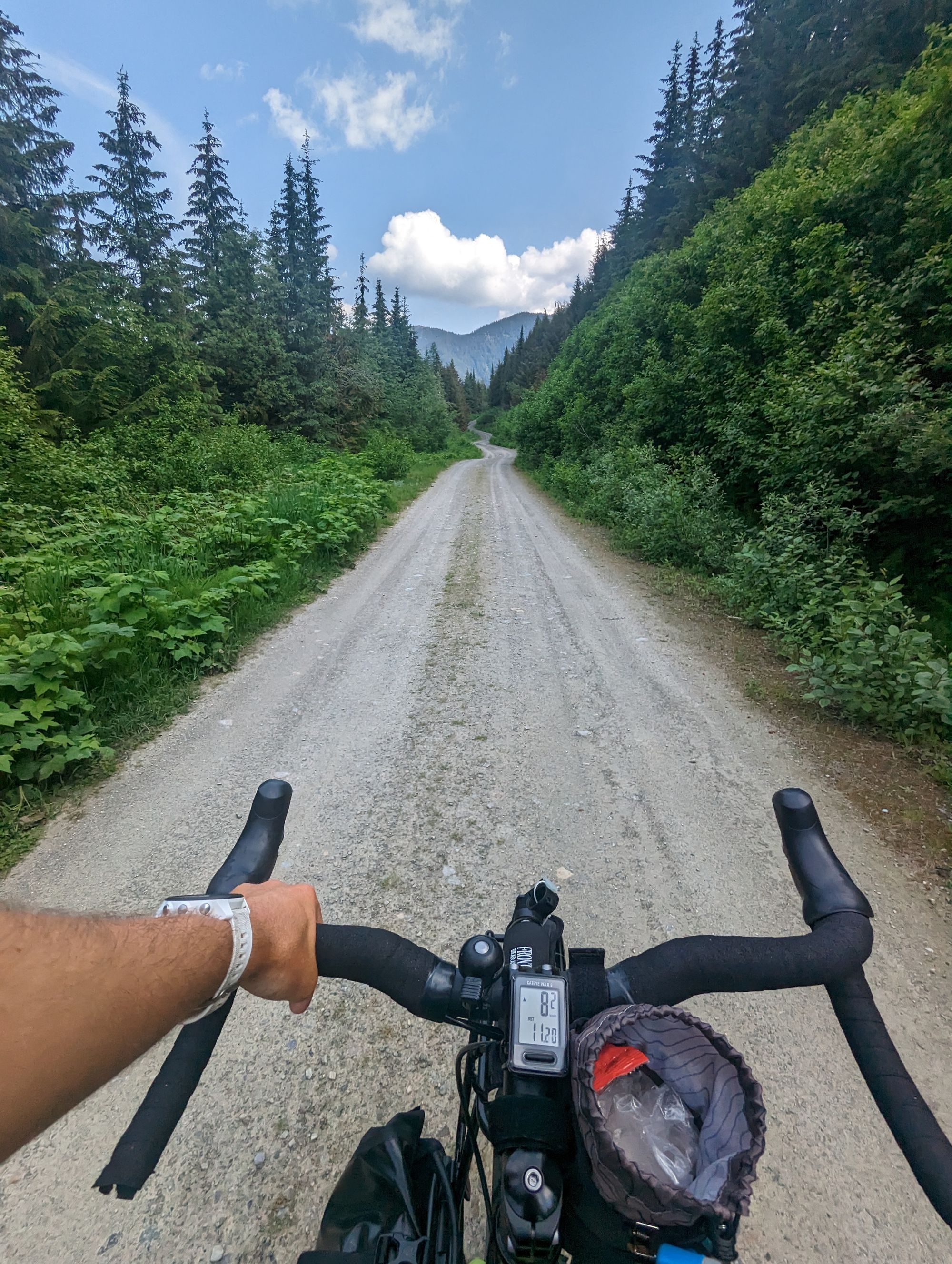
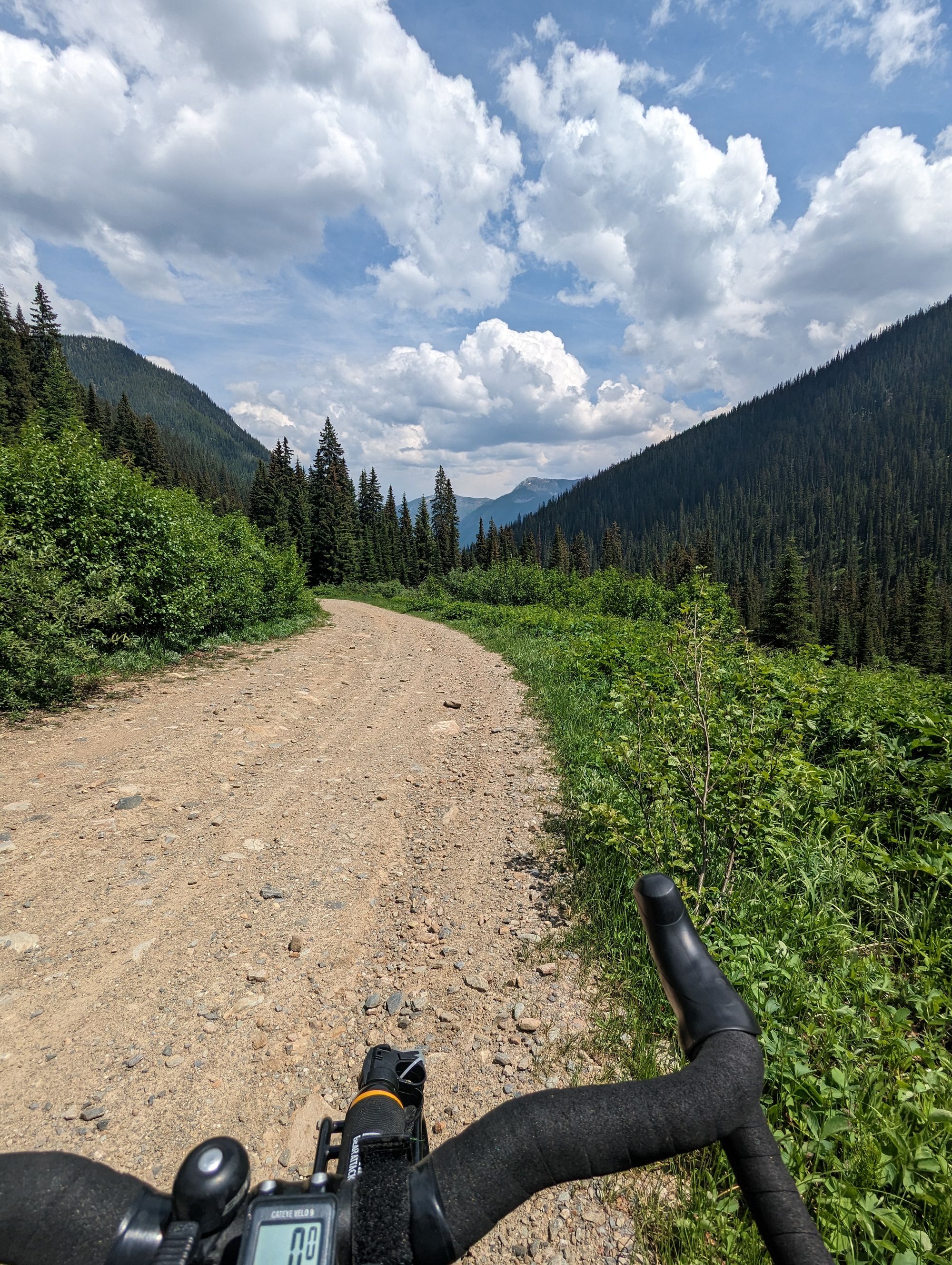
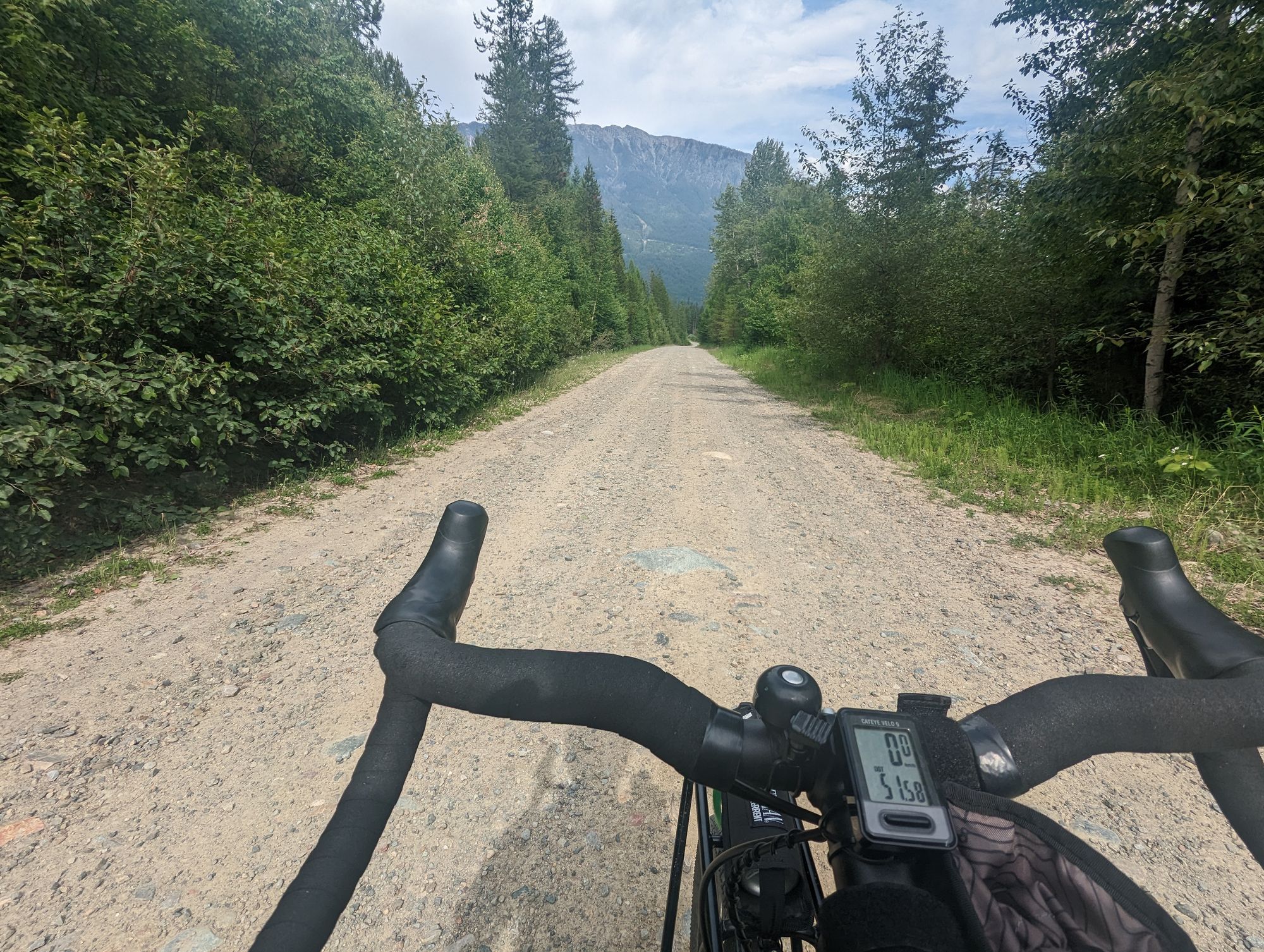
Eventually I came to a gravel road and the end of Gray Creek Forestry Road. I was VERY excited! I was now on a gravel road, but at least it's base was hard packed dirt. I now cruised at between 15-20km/h. When I passed the first farm, I breathed a sigh of relief as it meant I was returning to civilization. I rode about 20km along this road, passing more farms and private property signs. At some point the road became paved and I benefited from the flat surface and tailwind of the approaching storm. I was doing 25km/h now!
I found my campground, pulled in, and booked a site. I asked about Dan and they said he'd been in about an hour before, drank some soda, and kept going. He'd told me he might try to push to Cranbrook and sure enough he had. I hope he beat the storm there.
At this point rain was threatening and I put my phone into my waterproof bike bags and stopped taking pictures. I didn't want to water log my phone! Also all my mental energy was focused on getting setup and staying dry.
The storm was approaching fast. I found my tenting site which turned out to be some flat spots cut out of the dirt on the slope. The wind blew up the slope and was blowing really hard as the storm approached. Gusting. I setup the tent, tossed my sleeping pad, sleeping bag, and other things inside just as it started to pour. I took my bike to the campground showers and spent some time in the warm water to feel human again. I'm not sure I've ever sweat as much as I did going up Gray Creek Pass.
I bought an iced tea, ice cream sandwich, and bag of chips at the office. I needed the calories and the wind and rain meant I wouldn't be cooking tonight. I ate crackers and salami under the porch at the campground office. I returned to my tent, jumped in, and setup my sleeping pad and sleeping bag. I'd brought my e-reader, but immediately knew I didn't want to read. I wanted to sleep.
I fell asleep immediately. Legs aching. And the rain pounding down on the fly of my tent. But I was well protected and - apart from times when the rain came down so hard it woke me - I slept like a baby.
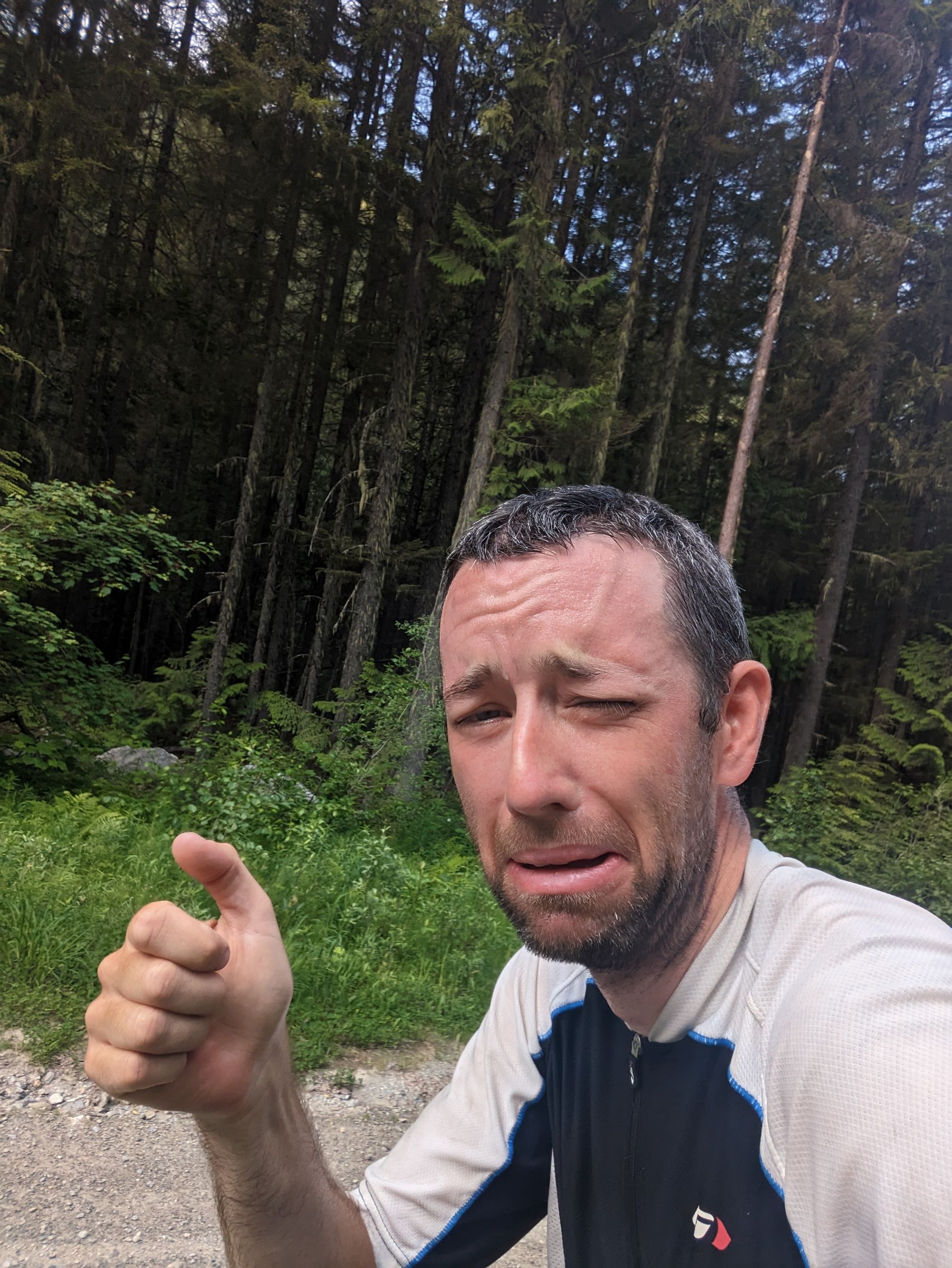
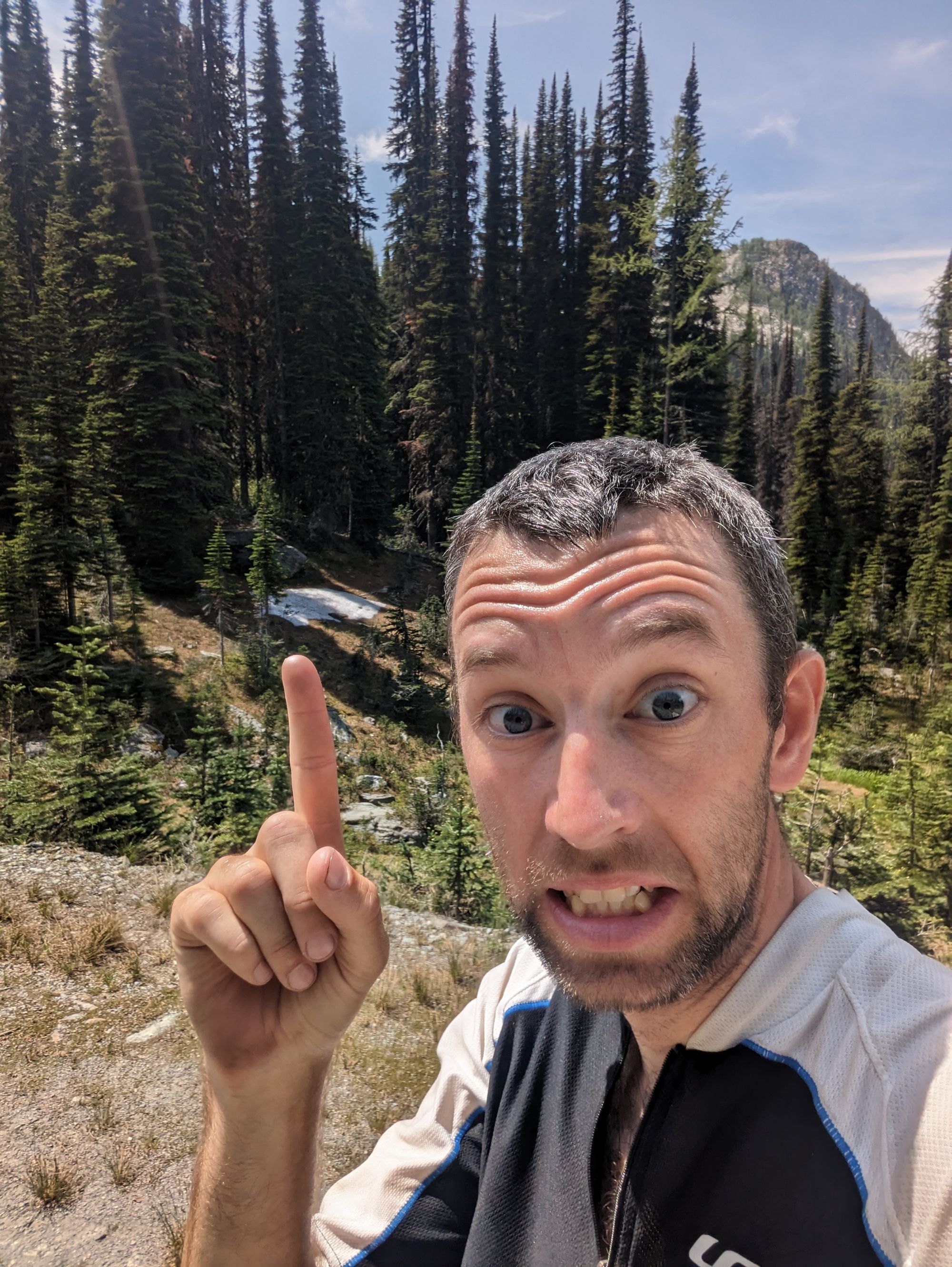
I'd made it to the highest point of the trip and pushed over what I hope is the hardest piece of "road" I'll encounter. As one camper said when I told them about it at the campground office, "Good for you. That builds character."
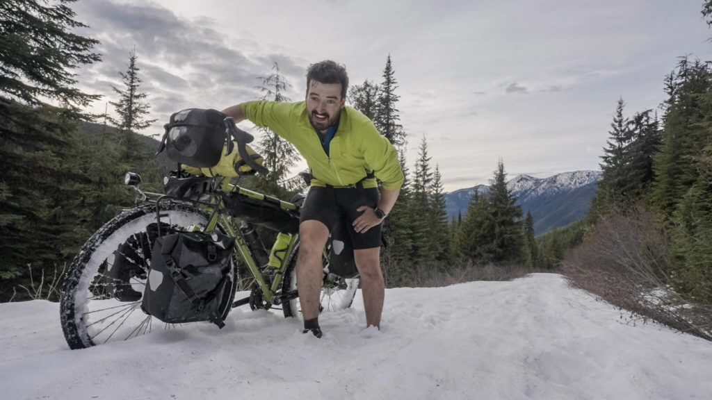
If my picture isn't next to the definition of "character" in the dictionary now, then I'll never understand the word.